|
Ubon Ratchathani Province
Ubon Ratchathani, often shortened to Ubon is one of the northeastern provinces (Isan) of Thailand, and the country's easternmost. Ubon is about 630 km (390 mi) from Bangkok. Neighbouring Provinces are (from west clockwise) Sisaket, Yasothon, and Amnat Charoen. To the north and east it borders Salavan and Champasak of Laos, to the south Preah Vihear of Cambodia.
Geography: At Khong Chiam the Mun River, the biggest river of the Khorat Plateau, joins the Mekong, which forms the northeastern boundary of Thailand with Laos. It is called "Maenam Song Si" or the "Mun River alluvium" because the brown water from Mekong River mixes with the blue water of the Mun. It is about 84 km (52 mi) from Ubon Ratchathani city centre.
The area in the Dângrêk Mountains where the borders of the three countries, Thailand, Laos, and Cambodia meet is promoted as the "Emerald Triangle", in contrast to the "Golden Triangle" in the north of Thailand. "Emerald" refers to the largely intact monsoon forests there.
Ubon Ratchathani boasts the following national parks:
Phu Chong–Na Yoi National Park is in the mountainous southern region of the province.
Kaeng Tana National Park is in Khong Chiam District.
Pha Taem National Park covers an area of 140 km2 (54 sq mi). Plateaus and hills dominate the park landscape. The sheer cliffs here are a result of earthquakes. The interesting places in the national park are Pha Taem and Pha Kham. On the cliffs surfaces are numerous prehistoric cave paintings from 3,000-4,000 years ago. These paintings depict scenes of fishing, rice farming, figures of people, animals, hands and geometric designs that depict life during the pre-historic times and reflect the ancient lifestyle of the people who lived there.
History: The city was founded in the late-18th century by Thao Kham Phong, descendant of Phra Wo and Phra Ta, who escaped from King Siribunsan of Vientiane into Siam Kingdom during the reign of King Taksin the Great. Later Thao Kham Phong was appointed to be "Phra Pathum Wongsa", the first ruler of Ubon Ratchathani. In 1792 Ubon Ratchathani became a province, and was also the administrative center of the monthon Isan. In 1925 it became part of monthon Nakhon Ratchasima. With the abolition of the monthon system in 1933, the province became a first level subdivision of the country. Until 1972, Ubon Ratchathani Province was the largest province of Thailand by area. Yasothon Province was split off from Ubon Ratchathani Province in 1972, followed by Amnat Charoen Province in 1993.
Economy: Ubon Ratchathani is the nation's leading rice-producing province. It earns more than 10 billion baht a year from rice sales.
Education: The two universities in the province are Ubon Ratchathani University Gate, Warin Chamrap District and Ubon Ratchathani University.
Health: The main hospital of Ubon Ratchathani Province is Sunpasithiprasong Hospital.
Symbols: The provincial seal shows a Lotus flower in a pond. This alludes to the meaning of the name of the province, which translates to 'royal city of the lotus flower'. The provincial flower is the lotus (Nymphaea lotus). The provincial tree is the Yang-na (Dipterocarpus alatus).
Administration: The province is divided into 25 districts (amphoe). The districts are further subdivided into 219 sub-districts (tambons) and 2,469 villages (mubans).
Transportation: The province has excellent communication links; Ubon Ratchathani Airport for air travel, Warin Chamrap for rail travel and multi-carriageways, Routes 1, 2 and 24 by road.
Source:https://en.wikipedia.org/wiki/Ubon_Ratchathani_Province
|
Ubon Ratchathani Province Map
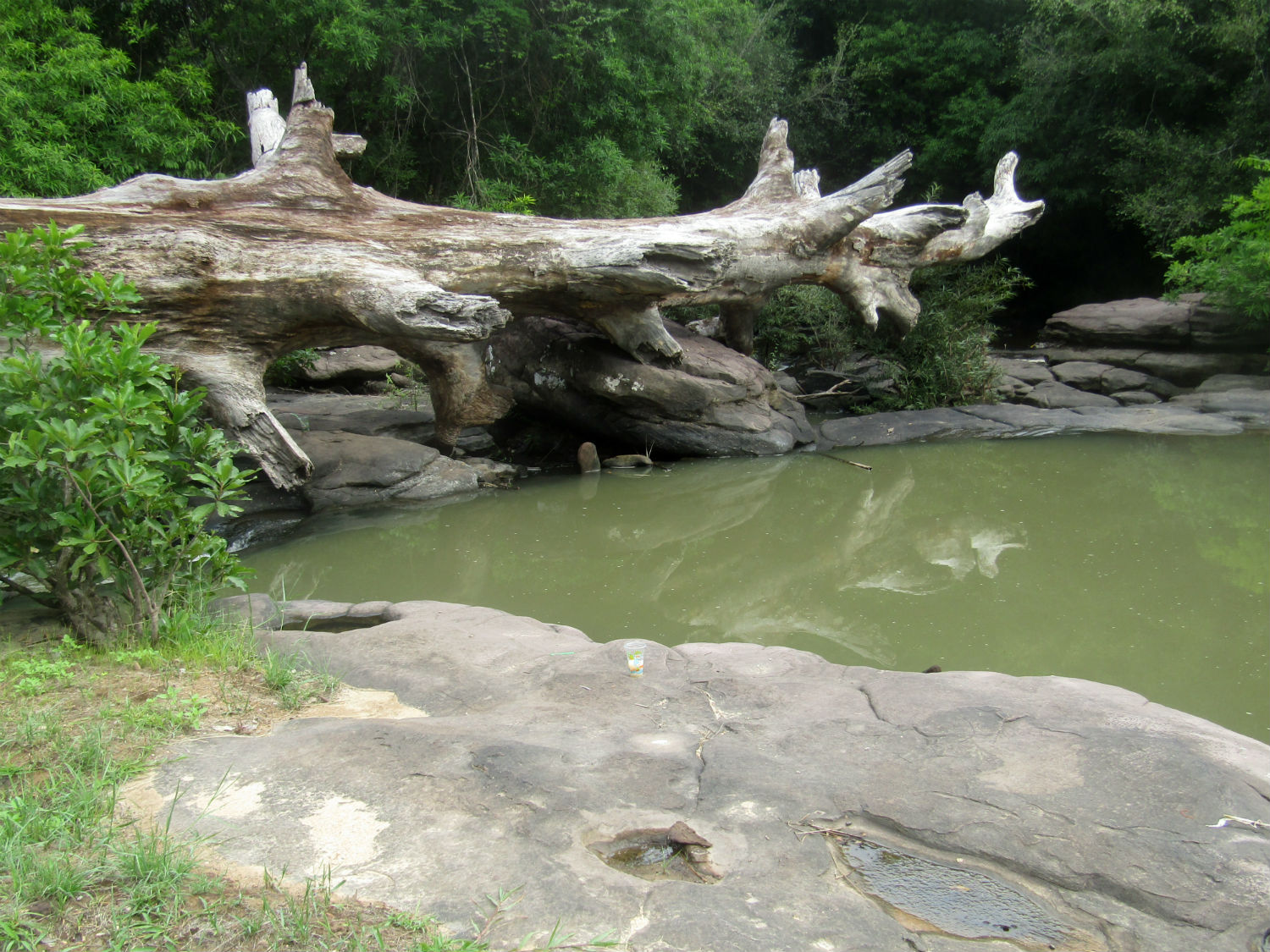 Kaeng Lamduan, Nam Yuen District,
Ubon Ratchathani Province
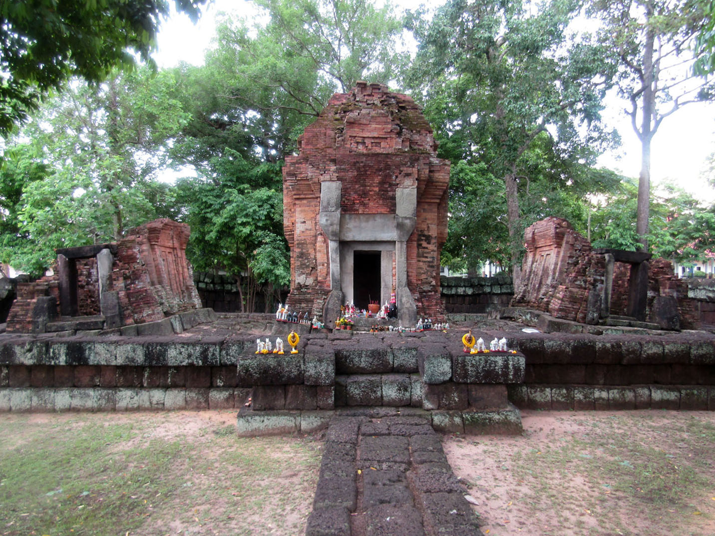 Praset Ban Ben, Thung Si Udon District,
Ubon Ratchathani Province
|
