Tours Section by Province |
| Name |
Ref. |
Description |
Era |
District/Province |
Location |
Date visited |
Price (baht) |
Rating/Comment |
| Chiang Rai Province |
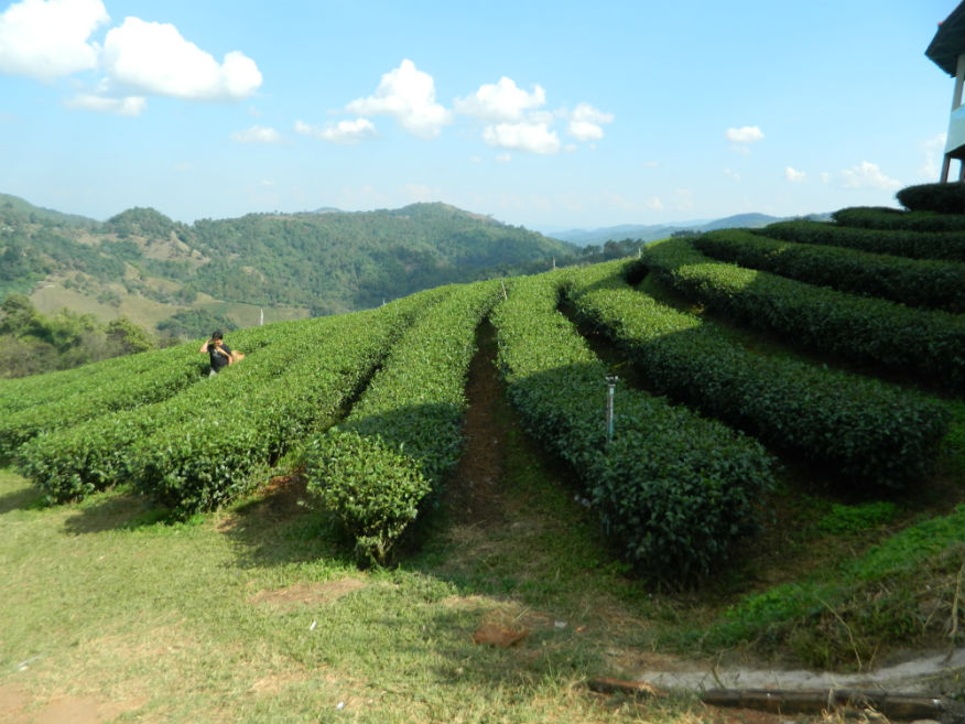
| 101 Tea Plantation |
16F |
Tea plantation |
|
Mae Fa Luang District |
Google Map |
22 Dec 2016 |
free |
award winning producer of Oolong tea set in a scenic setting (M,4,30m) |
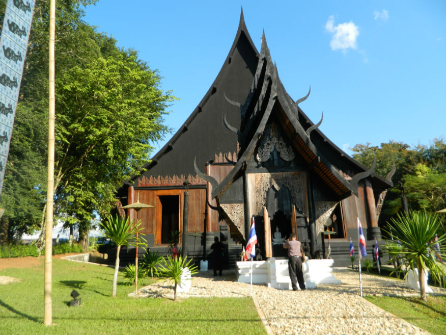
| Baan Dam (Black House) |
16F |
Artistic |
---- |
Mueang Chaing Rai District |
Google Map |
22 Dec 2016 |
90 |
unique creation of national artist, Thawan Duchanee. Part art studio, part museum, part home, Baan Dam is an eclectic mix of traditional northern Thai buildings interspersed with some outlandish modern designs (E,5,1h) |
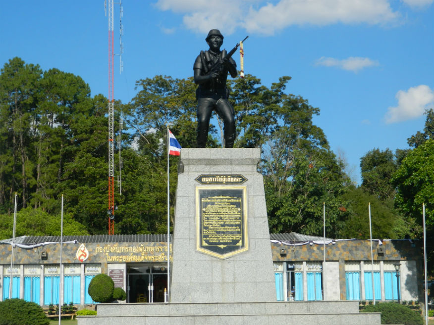
| Chiang Rai Army Memorial and King Rama IX Footprint |
16F |
Memorial |
1960's |
Mueang Chiang Rai |
Google Map |
21 Dec 2016 |
--- |
museum commemorates the struggle against communism while a foofprint moulding of the late king Rama IX is enshrined nearby (M,4,30m) |
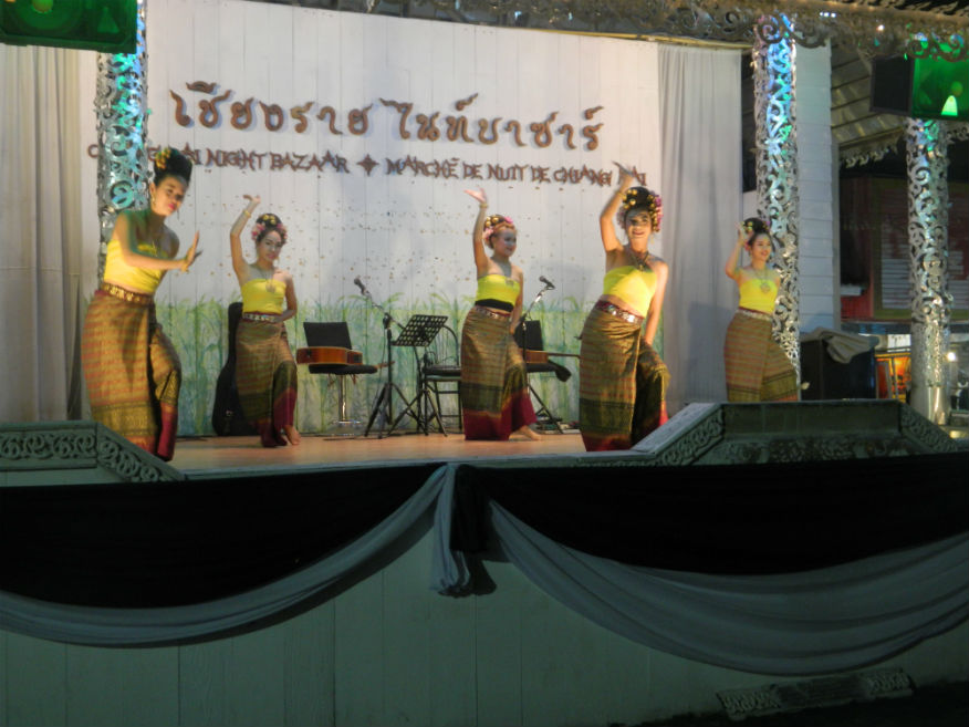
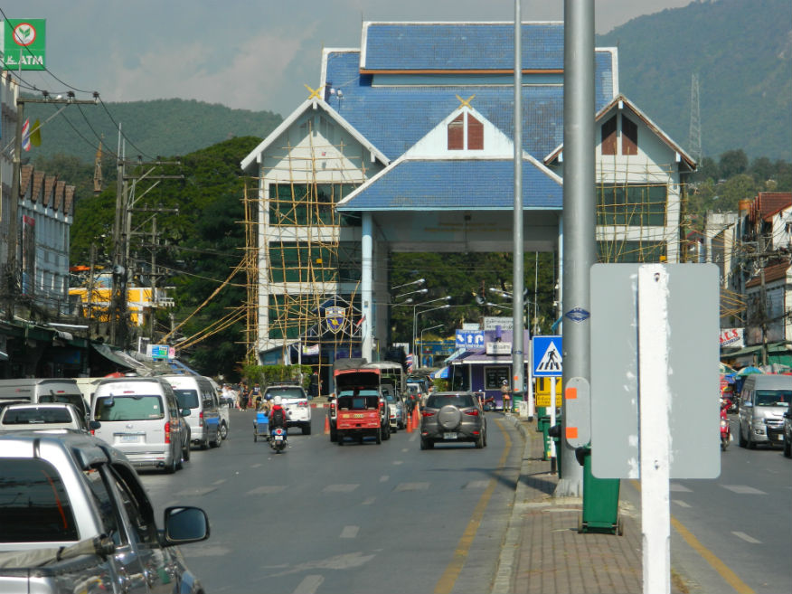
| Chiang Rai Night Bazaar |
16F |
Nightlife |
----- |
Mueang Chiang Rai |
Google Map |
21 Dec 2016 |
----- |
downtown is a pleasant and fun place for an evening stroll and an excellent option for snacks and a beer or dinner (E,4,2h) |
| Chiang Rai River Beach |
24E |
River Beach |
n/a |
Rop Wiang, Mueang Chiang Rai District |
Google Map |
15 Feb 2024 |
n/a |
(Easy-Chiang Rai 6.4km,Relaxing).....Popular river beach near the city during the dry season. Plenty of food vendors on the bank of the Kok River. |
| Chiang Saen |
16F |
Town |
since 13th century |
Chiang Saen District |
Google Map |
24-27 Dec 2016 |
----- |
Chiang Saen is an important entrepôt for Thailand's trade with other countries on the upper part of Mekong River....historically it was a significant city state founded in the 13th century and is surrounded by ancient ruins (E,4,1+d) |
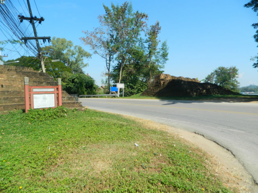
| Chiangsaen (or Pasak) Gate |
16F |
City gate ruin |
unknown |
Chiang Saen |
Google Map |
25 Dec 2016 |
--- |
located to the west of the city built in double semi-circle style for strong defence...some sort of gate is likely to have existed from 13th century (E,4,10m) |
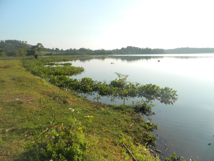
| Chiang Saen Lake (Nong Bong Kaai) |
16F |
Lake |
|
Chiang Saen District |
Google Map |
25 Dec 2016 |
200 |
a natural lake and marsh area 5 km from Chiang Saen and one of the country's prime bird-watching spots....a Ramsar site (conservation and sustainable use of wetlands)....mentioned in the chronicles as the site of an ancient city now submerged (M,4,1+h) |
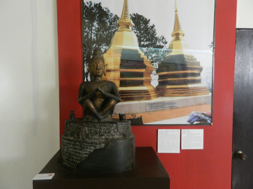
| Chiang Saen National Museum |
16F |
Museum |
from pre-historic to date |
Chiang Saen |
Google Map |
25 Dec 2016 |
free |
important museum especially in relation to it's city status rising in the 13th century (E,4,45m) |
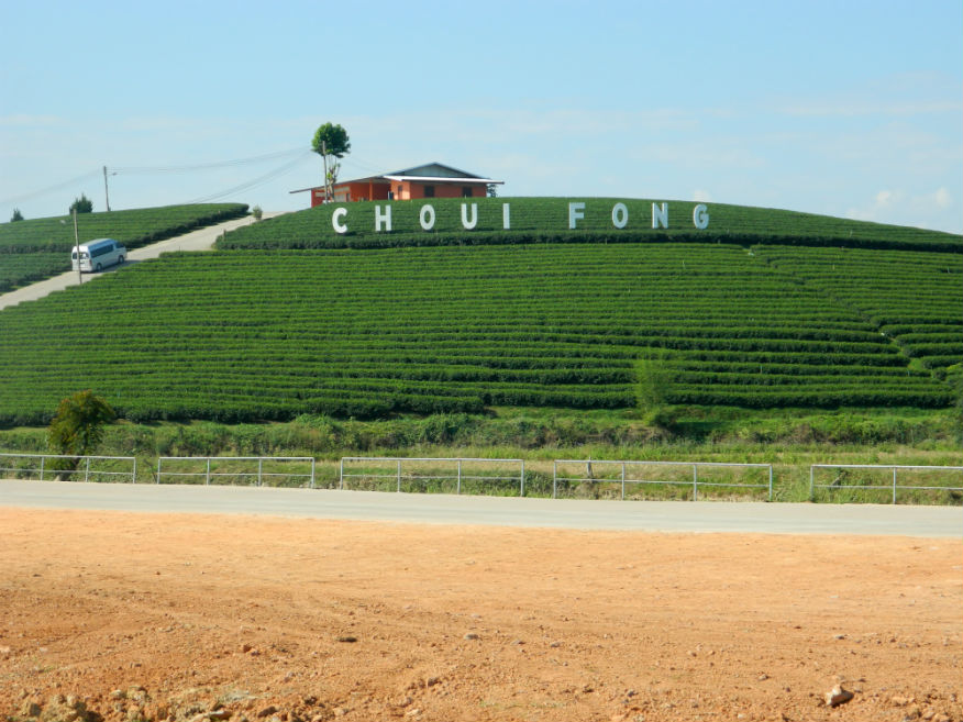
| Choui Fong Tea Plantation |
16F |
Tea plantation |
|
Mae Chan District |
Google Map |
22 Dec 2016 |
free |
modern cafe with a terrace overlooking a huge, scenic tea plantation with tours & a gift shop with a splendid selection of tea products (M,4,1.5h) |
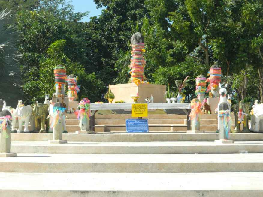
| City Naval Pillar |
16F |
Memorial |
13th century |
Mueang Chiang Rai |
Google Map |
22 Dec 2016 |
--- |
location of the foundation stone of the city built by King Mang Rai in 1263 (E,4,20m) |
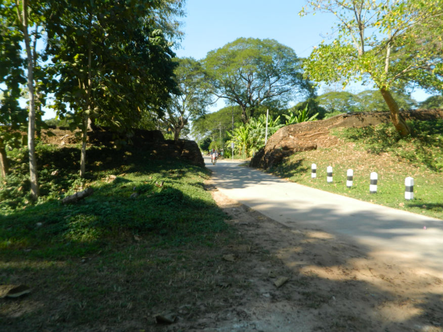
| Din-kor Gate/Fort |
16F |
Gate/Fort ruin |
unknown |
Chiang Saen |
south city |
26 Dec 2016 |
--- |
build in a horse-shoe shape with a moat, it was 2.5 metres high and 57 metres long, substantial defensive workings (E,3,15m) |
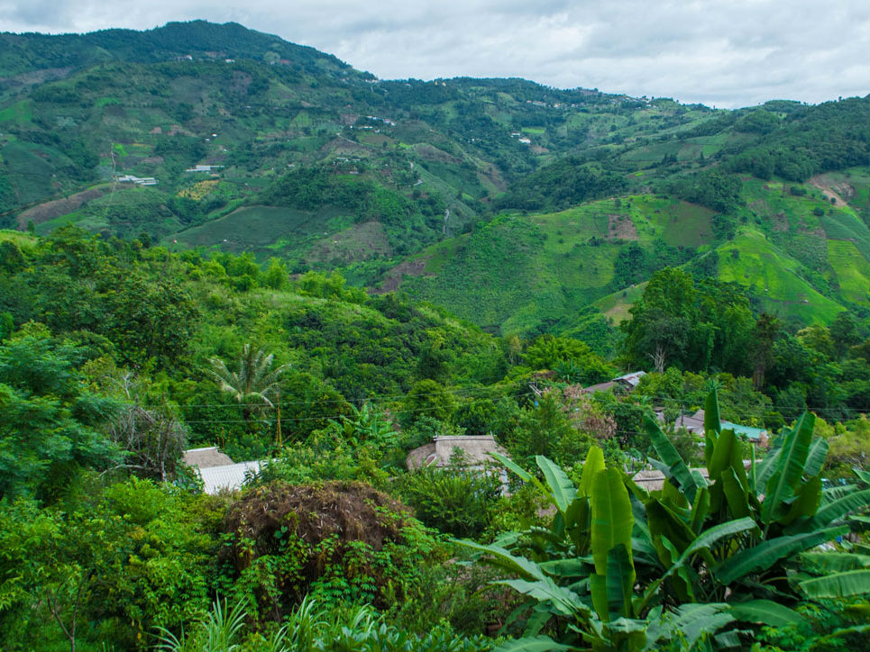
| Doi Tung |
16F |
Mountain |
|
Mae Si District |
Google Map |
24 Dec 2016 |
free |
mountain in the Daen Range in western Chiang Rai Province, elevation 1,389 m (M,4,30m) |
| Doi Ngu Reservoir |
24E |
Reservoir |
n/a |
Mae Chedi Mai, Wiang Pa Pao District |
Google Map |
13 Feb 2024 |
n/a |
(Difficult,Peaceful,15m).....Reservoir is 1.8km wide in an isolated location |
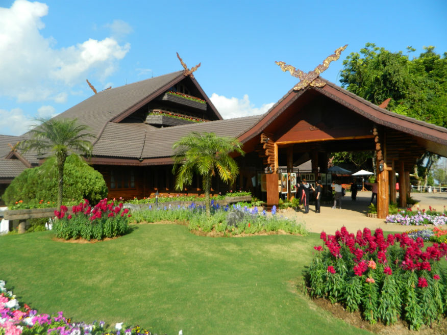
| Doi Tung Royal Villa |
16F |
Royal residence |
20th century |
Mae Fah Luang District |
Google Map |
24 Dec 2016 |
check |
former residence of Somdej Phra Srinagarindra, the Queen Mother (mother of the late King Rama IX) (M,4,45m) |
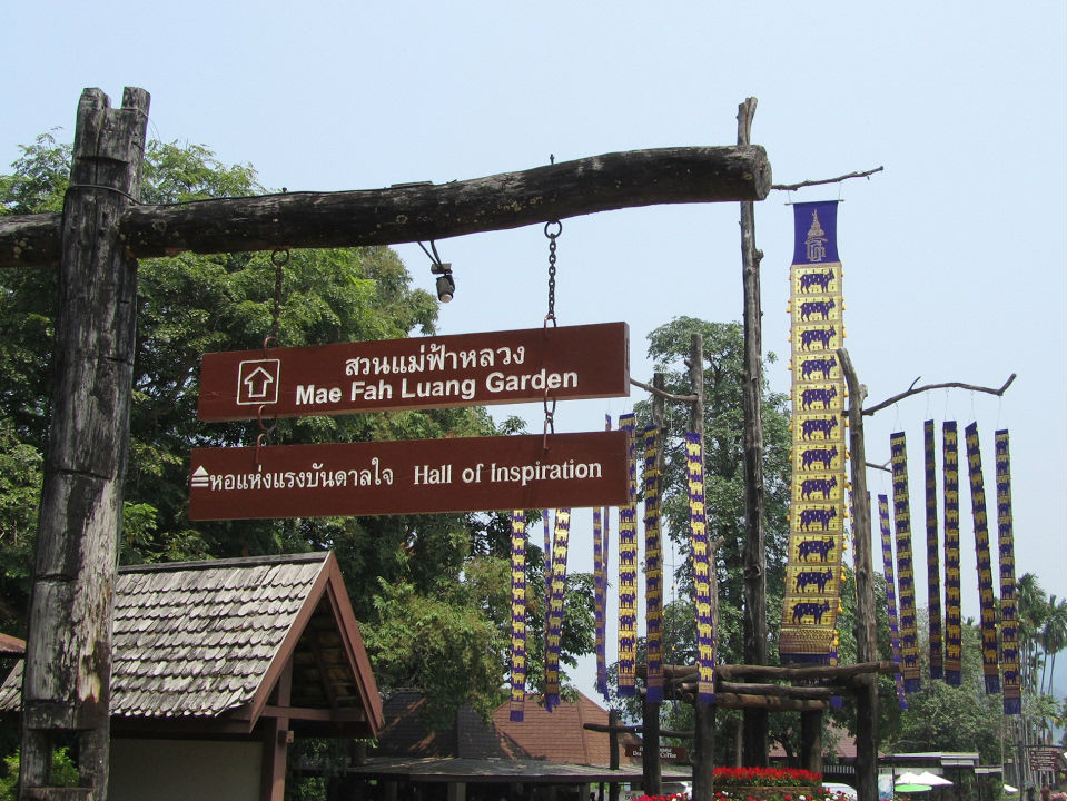
| Hall of Inspiration |
16F |
Memorial |
Rattanakosin |
Mae Fah Luang District |
Google Map |
24 Dec 2016 |
free |
dedicated to the life and works of the late King Bhumibol Adulyadej (Rama IX) (E,4,30m) |
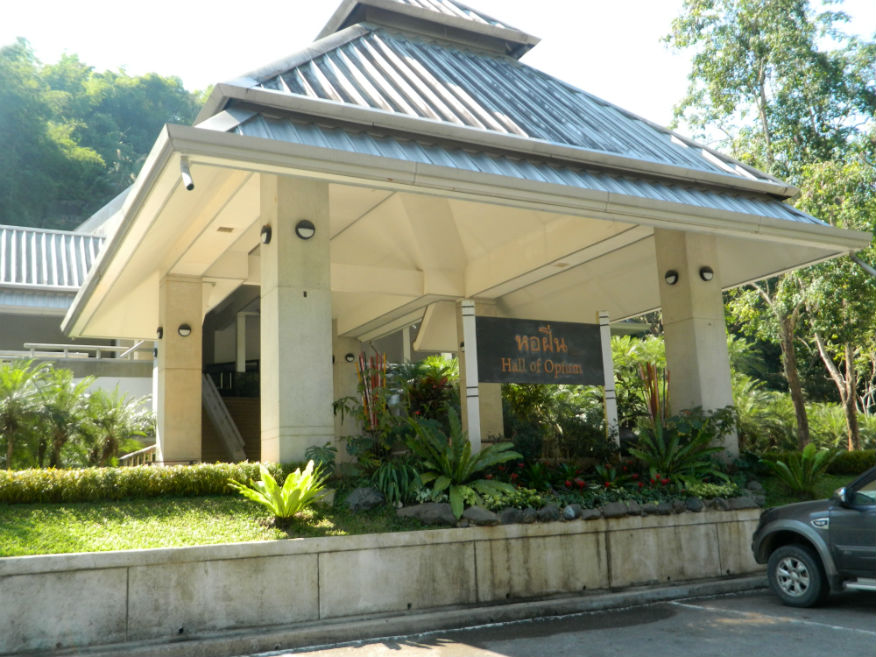
| Hall of Opium |
16F |
Museum |
----- |
Sob Ruak, Chiang Saen District |
Google Map |
26 Dec 2016 |
--- |
known as the Doi Tung Project, it was initiated by HRH the Princess Mother in 1988 through her desire to educate people about the background to opium production and instigate alternatives to provide a sustainable income (M,not visited) |
| Huay Pla Kang: Goddess of Mercy Chiang Rai |
24E |
Buddhist Temple |
2001 |
Mae Yao, Mueang Chiang Rai District |
Google Map |
15 Feb 2024 |
donations welcome |
(Easy-Chang Rai 8.3km,amazing,30-40 minutes).....Wat Huay Pla Kang is an epic temple in Chiang Rai. It's famous for its unique blend of Thai and Chinese architecture...more. |
| Leo Chiang Rai Stadium |
24E |
Stadium |
2012 |
Ban Du, Mueang Chiang Rai District |
Google Map |
15 Feb 2024 |
by ticket |
(Easy-Chiang Rai 8.3km,Locally Popular,per game).....Wikipedia |
| Mae Fa Luang Arboretum |
16F |
Arboretum |
|
Mae Fa Luang District |
Google Map |
24 Dec 2016 |
90 |
a stunning location on the summit of Doi Chang Moob (1,500 m) with view into Myanmar and as far as Laos....an arboretum in the midst of pine forests with native Sorrel Himalayan Cherry trees, fragrant orchid trees, hundreds of species of rhododendrons from different continents grown along with native Thai orchids (D,5,1+h) |
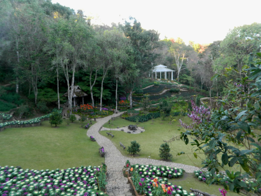
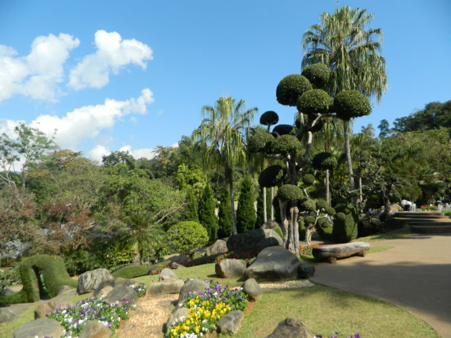
| Mae Fah Luang Gardens |
16F |
Gardens |
|
Mae Fa Luang District |
Google Map |
24 Dec 2016 |
check |
landscaped gardens sited high up on the mountain of Doi Tung with a stunning display of more temperate plants and flowers....set in over 10 acres of land....ornamental gardens initiated by the mother of the late king (M,5,2h) |
| Mae Sai |
16F |
Town |
----- |
Mae Sai District |
Google Map |
24 Dec 2016 |
----- |
town in the northernmost district of Chiang Rai Province in northern Thailand....it is a major border crossing between Thailand and Myanmar....Asian Highway Network AH2 crosses the Mae Sai River to the town Tachileik in Myanmar (E,3,1h) |
| Northern City Wall |
16F |
City Wall ruin |
unknown |
Chiang Saen |
north city |
26 Dec 2016 |
--- |
excavated between 2000 and 2001, the wall is 950 metres long with stepped ramparts, a seious attempt at defence....built during the second phase of construction of the city (E,4,20m) |
| Pa Tueng Hot Springs |
24E |
Hot Spring |
not stated |
Pa Tueng, Mae Chan District |
Google Map |
16 Feb 2024 |
enquire |
(Moderate-Chiang Rai 34.2km,Excellent,30-60 minutes).....www.lovethailand.org |
| Pha Hi Village |
24E |
Village |
n/a |
Pong Ngam, Mae Sai District |
Google Map |
14 Feb 2024 |
n/a |
(Moderate from Mai Sai 16.3 kms,Outstanding Scenery).....CTN News |
| Pha Mi |
24E |
Village |
n/a |
Wiang Phang Kham, Mae Sai District |
Google Map |
14 Feb 2024 |
n/a |
(Moderate from Mai Sai 9.6 kms,Wonderful Scenery).....CTN News |
| Phra Borommathat Putta Nimit Chedi |
16F |
Buddhist Chedi/Temple |
unknown |
south of Chiang Saen |
Google Map |
26 Dec 2016 |
accepts donations |
a chedi built on the site of three ancient chedis afording remarkable views of the Mekong River and beyond (E,4,20m) |
| Phu Chi Fa |
19B |
Viewpoint |
|
Thoeng District |
Google Map |
15 May 2019 |
n/a |
(D,4+,1h).....Learn |
| Pong Phrabat Hot Springs |
24E |
Hot Spring |
not stated |
Ban Du, Mueang Chiang Rai District |
Google Map |
16 Feb 2024 |
Rooms from 50 |
(Easy-Chiang Rai 9.5km,Average,** minutes).....Practical and relatively cheap. A bit run down and manly used by locals. Free for foot bath. |
| Saint Stephen's Church |
24E |
Catholic Church |
modern |
Pa Tueng, Mae Chan District |
Google Map |
16 Feb 2024 |
donations welcome |
(Moderate-Chiang Rai 31.6km,Excellent,15 minutes).....New church built in a glorious location in the Mae Chan River Basin. They take care of abandoned or orphaned children. |
| Santikhiri (Mae Salong) |
16F |
Village |
----- |
Mae Fa Luang District |
Google Map |
23 Dec 2016 |
----- |
village of Santikhiri, formerly known as Mae Salong is in the Thai highlands on Doi Mae Salong mountain of the Daen Lao Range in the northernmost province of Thailand....the area has an alpine-like landscape and climate, and known for its hill tribe villages, tea plantations, and cherry blossoms (M,4,2h) |
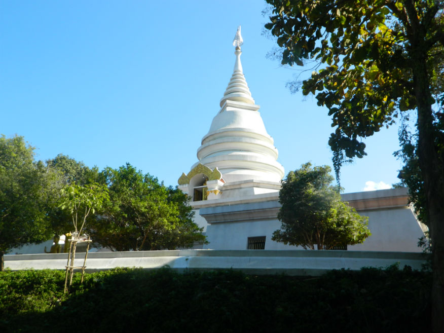
| Santikhiri Pagoda |
16F |
Buddhist Pagoda/Temple |
under construction in 2016 |
Mae Fa Luang District |
Google Map |
23 Dec 2016 |
accepts donations |
new construction above the village of Santikhiri, formerly Mae Salong, has recently been named as Phra Boromathat Chedi (E,4,30m) |
| Singha Park |
16F |
Park and gardens |
|
Mueang Chiang Rai District |
Google Map |
22 Dec 2016 |
free |
scenic park in a farmlike setting with tea plantations, orchards, trails, a tram & a petting zoo....run by the Boon Rawd Brewery (producer of Singha beer) (M,4,2h) |
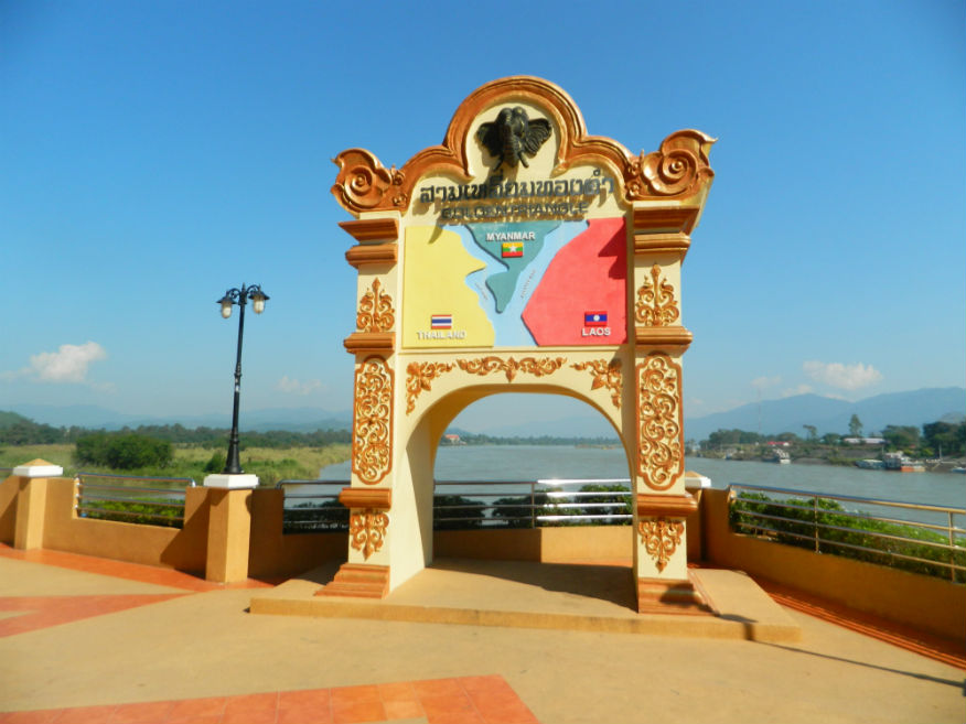
| Sob Ruak (Golden Triangle) |
16F |
Park |
----- |
Chiang Saen District |
Google Map |
26 Dec 2016 |
----- |
historically a centre for trade in opium although there is little evidence of it today....the small village is where the Ruak and Mekong rivers meet and forms the border of three countries, Thailand, Laos and Myanmar. (E,4,1h) |
| Somdet Ya Park |
24E |
Park |
not stated |
Ban Du, Mueang Chiang Rai District |
Google Map |
16 Feb 2024 |
none |
(Easy-Chiang Rai 9.3km,Peaceful,** minutes).....Pleasant exercise park under Royal patronage beside Nong Bua lake and near the Chiang Rai Rajabhat University |
| Tham Luang Nang Non |
24E |
Cave System |
n/a |
Pong Pha, Mae Sai District |
Google Map |
14 Feb 2024 |
none |
(Moderate-Mai Sai 13.2km,Exceptional,30-60 mins).....Wikipedia |
| Tham Sai Tong |
24E |
Cave/Pond |
n/a |
Pong Pha, Mae Sai District |
Google Map |
14 Feb 2024 |
none |
(Moderate-Mai Sai 13.2km,Exceptional,30-60 mins).....Before the Tham Luang rescue operation there existed a small basin called Khun Nam Nang Non but.....more. |
| Vetiver Grass Development Centre |
24E |
Project |
recent |
Huai Khrai, Mae Sai District |
Google Map |
14 Feb 2024 |
n/a |
(Moderate-Chang Rai 44.6km,interesting,20 mins).....This project is all about mitigating natural disasters.....more. |
| Volcanic Stone Thawee Sin |
24E |
Natural Feature |
n/a |
Mae Chedi Mai, Wiang Pa Pao District |
Google Map |
13 Feb 2024 |
n/a |
(Easy using HWY 118,Good,10m).....Natural spring pouring from volcanic rock convenient to a rest stop with dining facilities. |
| Wat Arthi Ton Kaew |
16F |
Temple ruin |
early 16th century |
Chiang Saen |
Google Map |
27 Dec 2016 |
--- |
constructed in 1515 by Phra Muang Kaeo, ruler of Chiang Mai in the attempt of reconciliation at a time of conflict between different monasteries (E,3,15m) |
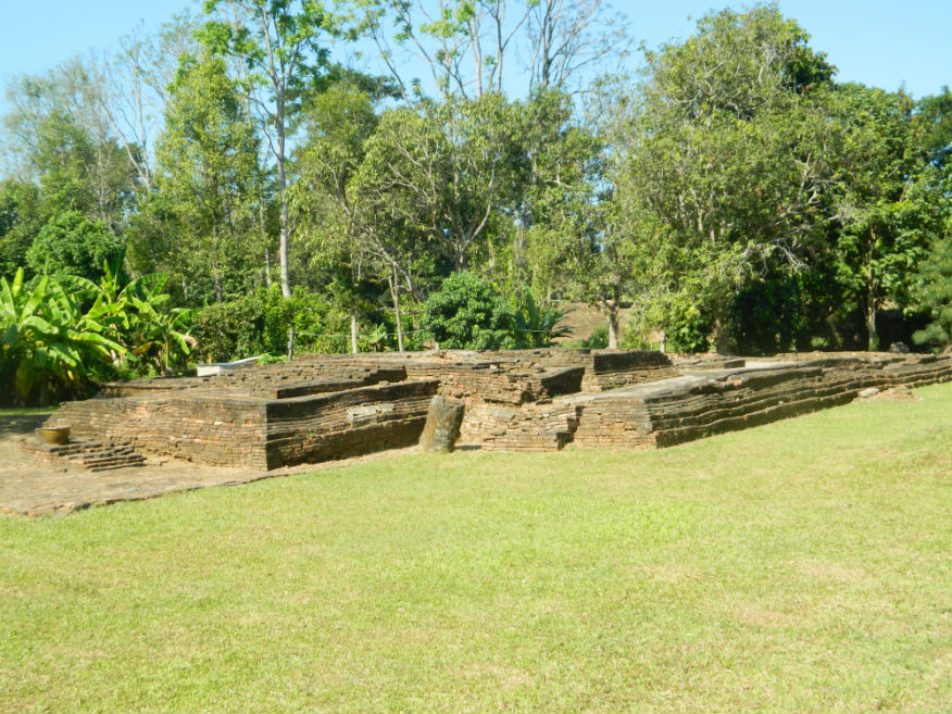
| Wat Ban Rong Wat |
16F |
Temple ruin |
15th century |
Chiang Saen |
southeast city |
26 Dec 2016 |
--- |
consisting of four buildings, a viharn with attached room and three chedis....the temple was abandoned late 16th century when the town was captured by the Burmese (E,3,15m) |
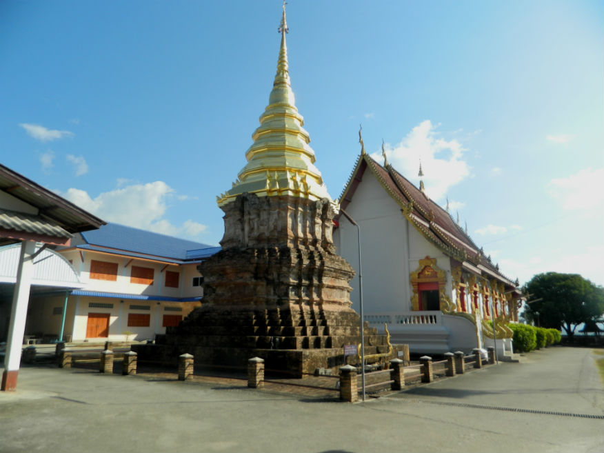
| Wat Boonyuen |
16F |
Temple ruin |
1366 |
Chiang Saen |
south of the city |
27 Dec 2016 |
--- |
built in 1366 by Thao Mahaphrom, the ruler of Chiang Rai for keeping Buddha relics ....reconstructed in 1796 during Burmese occupation but abandoned in 1804 (E,4,20m) |
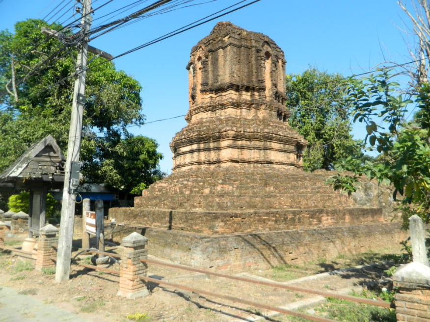
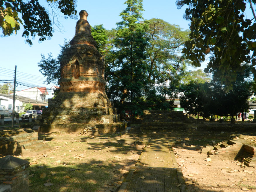
| Wat Chedi Luang |
16F |
Temple ruin |
14th/15th century |
Chiang Saen |
Google Map |
25 Dec 2016 |
--- |
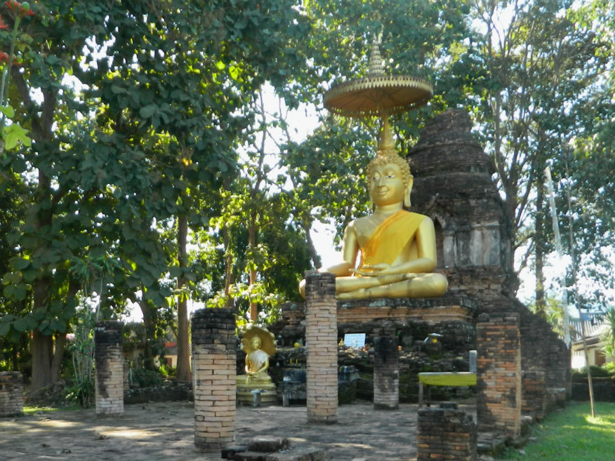
built in 1344, according to legend by Phaya Saen Phu, King of the Mang Rai Dynasty, to house Buddha relics...the chedi was damaged by an earthquake in 2014 and now the viharn is covered to protect a new seated Buddha image (E,4,15m) |
| Wat Chetawan |
16F |
Temple ruin |
17th century |
Chiang Saen |
Google Map |
27 Dec 2016 |
--- |
according to the Yonok chronicle, Wat Chetawan was constructed around 1636/37 during a period of Burmese control, built at the palace of Nang Fa Ka Pruak...it has a bell-shaped chedi behind a viharn facing east....in the viharn is a large pedistal for a Buddha image (E,3,15m) |
| Wat Chiang Man |
16F |
Temple ruin |
pre 13th century |
Chiang Saen |
Google Map |
27 Dec 2016 |
--- |
legend states that it was built in 640 and named Aram Chiang Man Chang Khung to house Buddha relics....rebuilt after 1327 when Phaya Saenpoo founded the city but abandoned in 1804 (E,3,10m) |
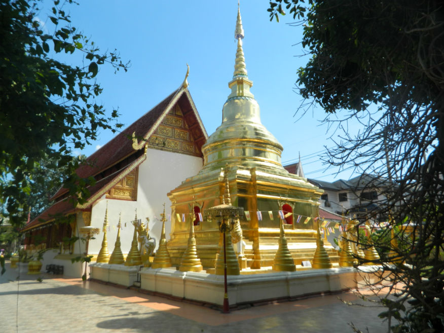
| Wat Jed Yod |
16F |
Buddhist Temple |
Rattanakosin |
Mueang Chiang Rai |
Google Map |
21 Dec 2016 |
accepts donations |
temple of seven peaks (spires), built in 1844 by a Buddhist monk named Brakrubakuntha Kunthawungso....upgraded to a third grade Royal temple in 1978 (E,3,20m) |
| Wat Klong Wiang |
16F |
Buddhist Temple |
15th century |
Mueang Chiang Rai |
Google Map |
21 Dec 2016 |
accepts donations |
temple dating back to 1432 displaying Lanna-style at its best....noteworthy are the colourful guardian statues offering protection to the city according to Lanna belief with elephants in the back and the "No Killing Area" warning at the entrance....temple consists of an assembly hall, contemporary chedi and scripture hall (E,3,20m) |
| Wat Ku Tao |
16F |
Temple ruin |
late 16th century |
Chiang Saen District |
west of the city |
27 Dec 2016 |
--- |
located ouside the city to the west, temple has a chedi with vertical rounded chamber on a square base with viharn in front with a pedistal for the Buddha image (E,3,10m) |
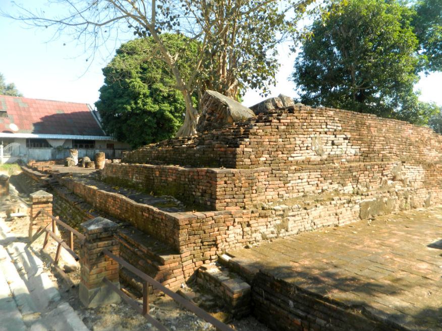
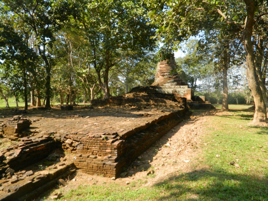
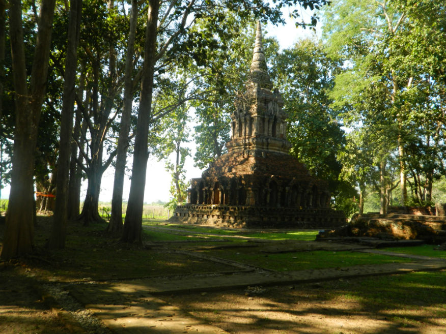
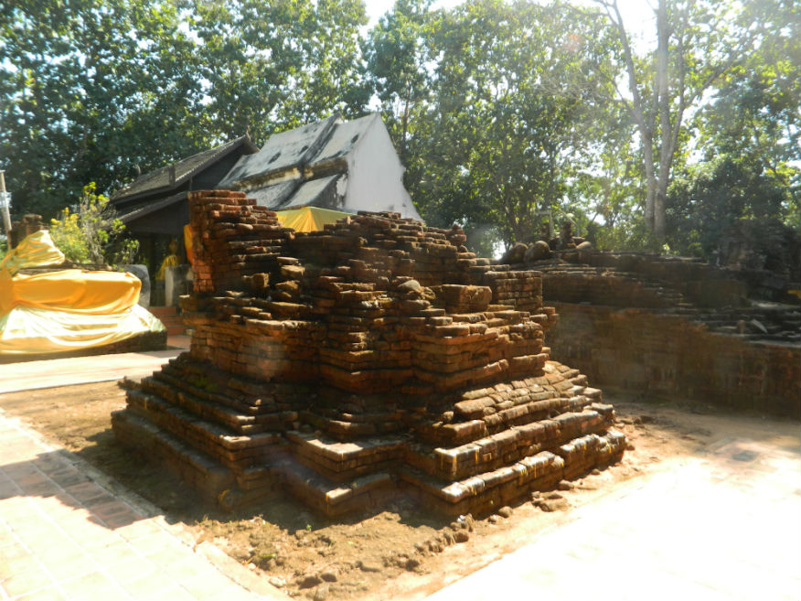
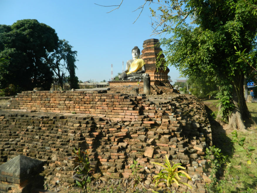
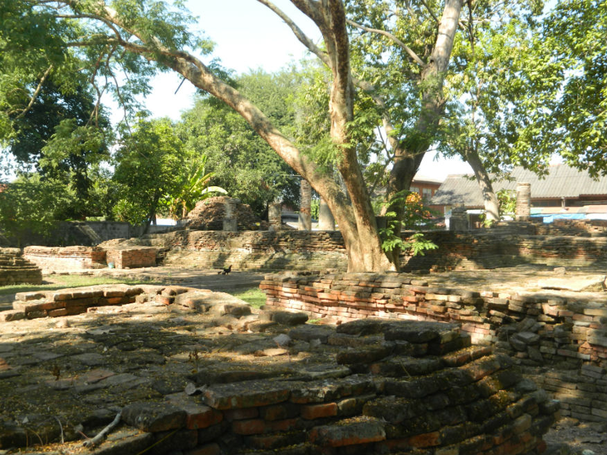
| Wat Maha That |
16F |
Temple ruin |
15th/16th century |
Chiang Saen |
Google Map |
25 Dec 2016 |
--- |
temple ruin without provenance consisting of a mandapa (mondrop) with a pyramid roof (E,3,10m) |
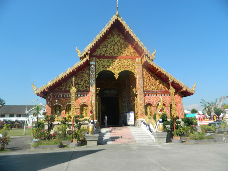
| Wat Ming Meuang |
16F |
Buddhist Temple |
13th century |
Mueang Chiang Rai |
Google Map |
21 Dec 2016 |
accepts donations |
small temple housing the spirit of the city (ming meuang) in an exquisitely carved and decorated Lanna-style, almost Laotian....it dates from 1262, built during the reign of King Mengrai the Great (1239-1311) (E,4,20m) |
| Wat Mongkol |
16F |
Temple ruin |
Golden Age (16th century) |
Chiang Saen |
near the Northern Gate |
26 Dec 2016 |
--- |
temple was excavated between 2005/6 and found to have a viharn, chedi and mondrop with a large ubosot added later (E,3,15m) |
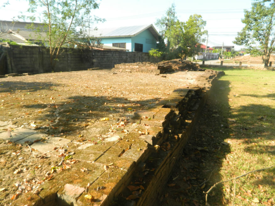
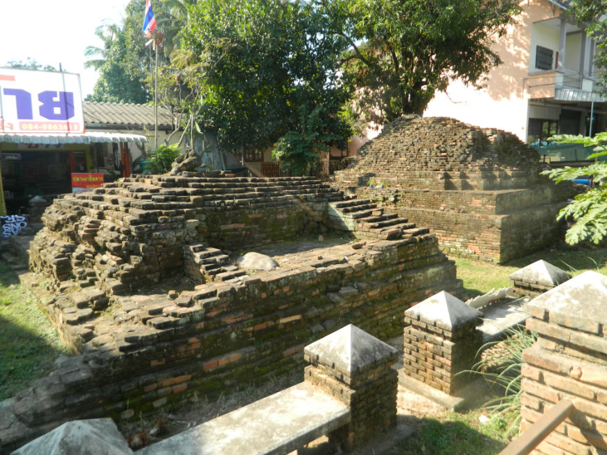
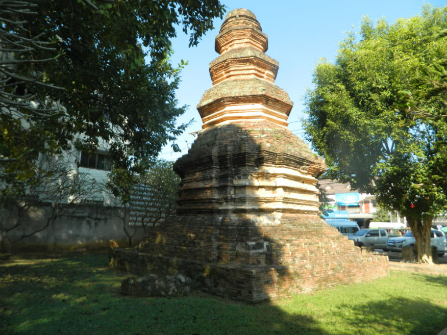
| Wat Muen Chiang |
16F |
Temple ruin |
1488 |
Chiang Saen |
south city |
26 Dec 2016 |
--- |
built by the ruler of Chiang Saen in 1488 for enshrining relics, the brick-style chamber of the chedi is adorned with stucco reliefs....the vihirn in front faces east (E,3,15m) |
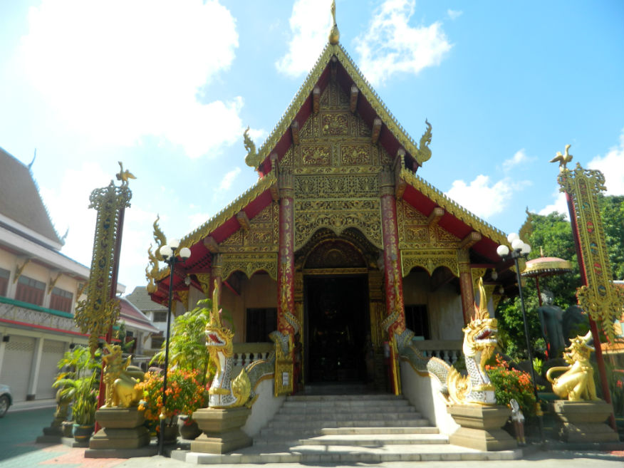
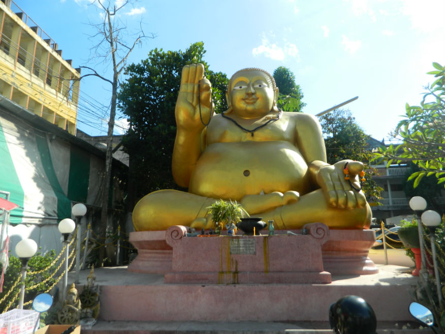
| Wat Mung Muang |
16F |
Buddhist Temple |
pre 13th century |
Mueang Chiang Rai |
Google Map |
21 Dec 2016 |
accepts donations |
impressive Lanna-style assembly hall while outside sits a large pot-bellied Buddha image....it is assumed that a temple had existed here since before the foundation of the city....there is a remarkable story that during WWII, bombs were dropped on the city; of the ones that fell on the temple, none exploded (E,3,20m) |
Wat Mung Muang |
16F |
Temple ruin |
14th century |
Chiang Saen |
Google Map |
27 Dec 2016 |
--- |
one of the older temples, the chedi has a vertically square chamber in prasat style with niches....although similar to the one at Wat Pa Sak, it is older (E,3,10m) |
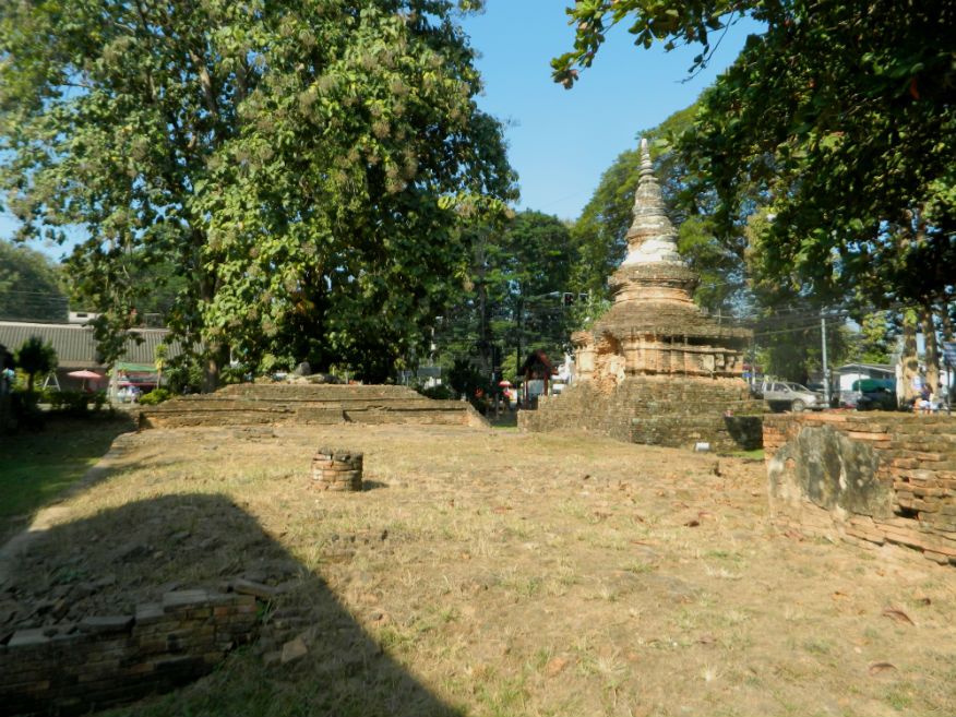
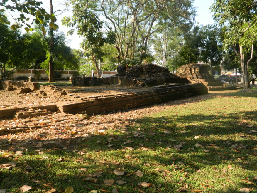
| Wat Pa Sak |
16F |
Temple ruin |
unknown |
Chiang Saen |
Google Map |
25 Dec 2016 |
--- |
a temple of some importance with a complex number of structures, the chedi has Lamphun design features while other structures show Phungam, Chinese, Khmer and Sukhothai influence (E,4,15m) |
| Wat Phra Baut |
16F |
Temple ruin |
14th century |
Chiang Saen |
west city |
27 Dec 2016 |
--- |
near the National Museum opposite Wat Mung Muang, built in 1344 in the reign of Phaya Gue Na....chedi is bell-shaped hiding a prasat inside with the earlier style square chamber with niches....due to its condition, the Fine Arts Department broke open the outer shell revealing a magnificent stucco lined Buddha image inside (E,4,10m) |
| Wat Phra Chao Thong Noi |
16F |
Temple ruin |
16th century |
Chiang Saen |
Google Map |
27 Dec 2016 |
--- |
located at the centre of the city, built in the golden age but without provenance....all that exists are the bases of the viharn and chedi (E,3,10m) |
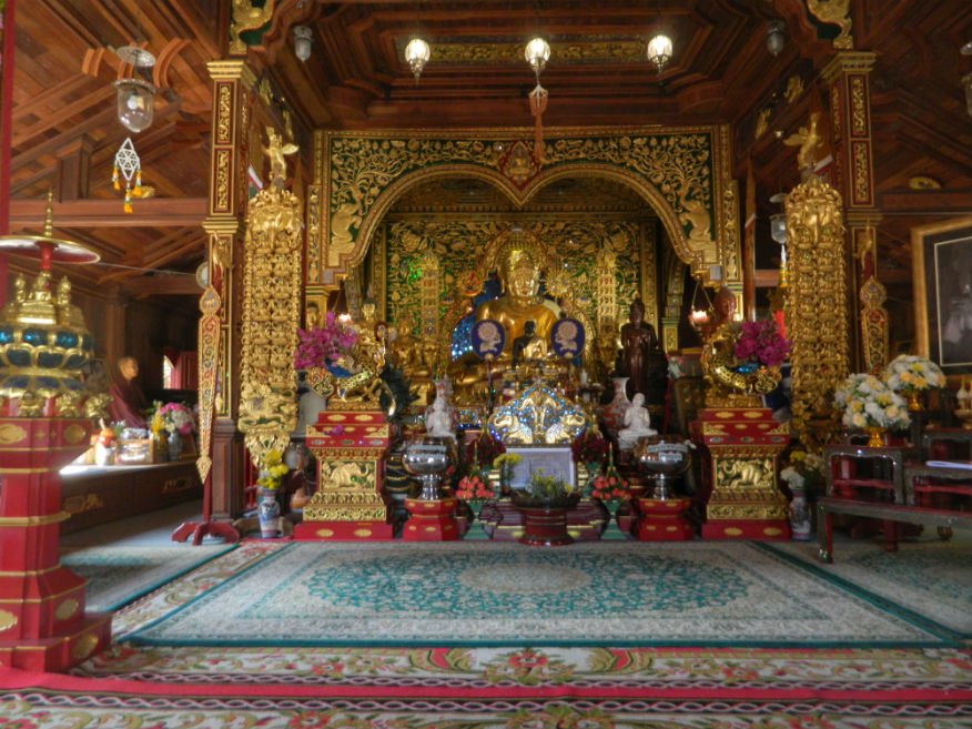
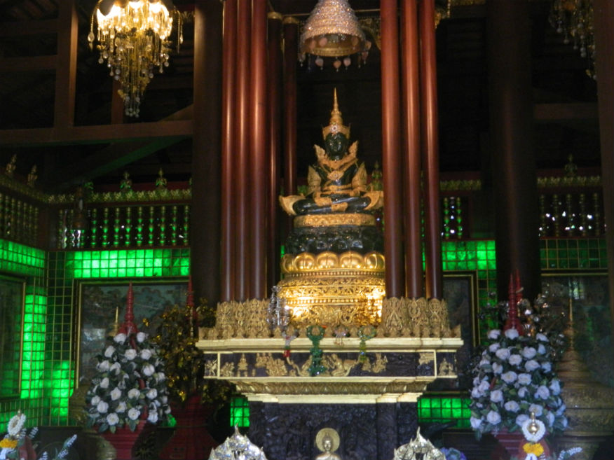
| Wat Phra Kaew |
16F |
Buddhist Temple |
Lanna |
Mueang Chiang Rai |
Google Map |
21 Dec 2016 |
accepts donations |
the most revered temple in Chiang Rai known as the Temple of the Emerald Buddha....the magnificent emerald Buddha, now in Bangkok, was discovered in 1434 after the spire was struck by lightning....the present emerald Buddha, Phra Yok was made from jade imported from Canada(E,4,30m) |
| Wat Phra Khao Pan |
16F |
Buddhist Temple |
early 17th century on a much earlier religious site |
Chiang Saen |
Google Map |
27 Dec 2016 |
accepts donations |
temple with the ruin of an important chedi with a square chamber and bell-shaped stupa....built in the period of Phaya Luang of Chiang Saen about 1615/16 but on the site of temple claimed to be built in 761 (E,3,15m) |
| Wat Phra Khao Pan |
16F |
Temple ruin |
early 17th century on a much earlier religious site |
Chiang Saen |
Google Map |
27 Dec 2016 |
--- |
important chedi with a square chamber and bell-shaped stupa....built in the period of Phaya Luang of Chiang Saen about 1615/16 but on the site of temple claimed to be built in 761 (E,3,15m) |
| Wat Phra Sing |
16F |
Buddhist Temple |
not stated |
Mueang Chiang Rai District |
Google Map |
21 Dec 2016 |
accepts donations |
temple used to house a major Buddha statue, the Phra Buddha Sihing, now enshrined in Chiang Mai....special feature is the Lanna-style Ubosot and the wooden door panels carved by Chiang Rai contemporary craftsmen (E,4,20m) |
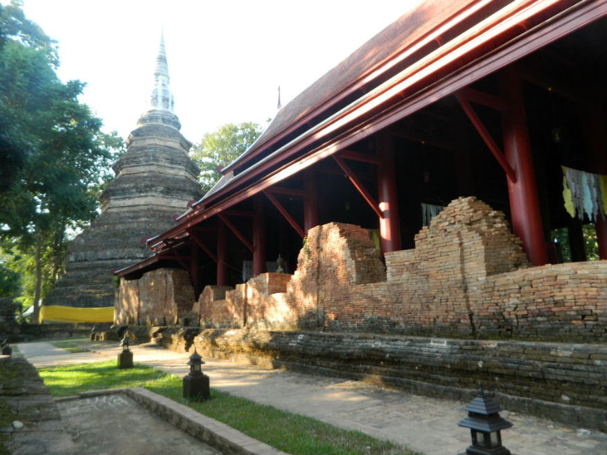
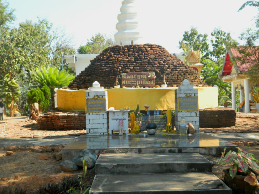
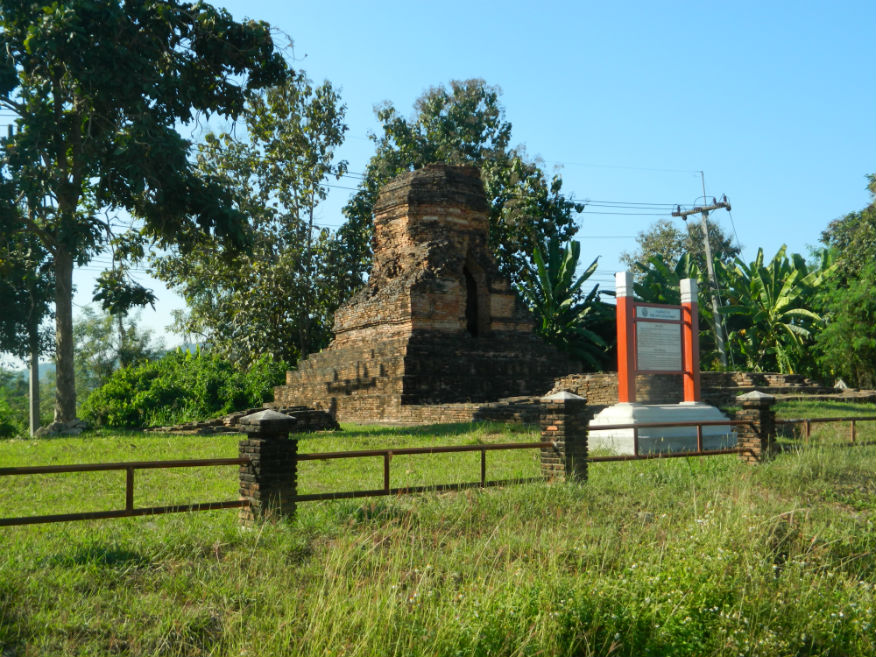
| Wat Phra That Chomkitti |
16F |
Temple ruin |
14th/15th century |
Chiang Saen |
Google Map |
25 Dec 2016 |
--- |
according to legend the temple it was built to enshrine the Buddha’s hair...the chedi was built later in 1487 by the ruler Muen Chiang Song...the temple offers excellent views east across the Mekong River towards Laos (E,4,15m) |
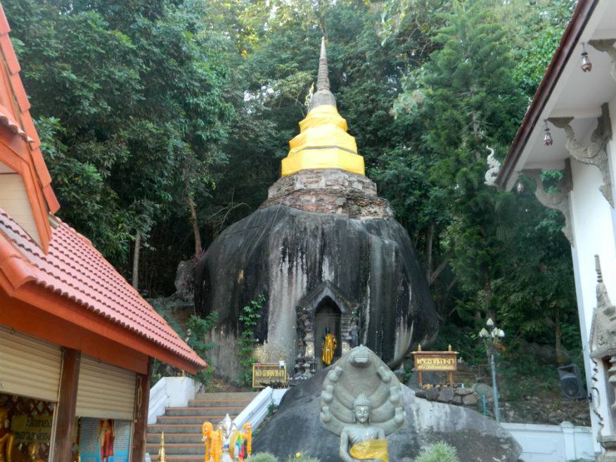
| Wat Phra That Doi Chom Thong |
16F |
Buddhist Temple |
pre 13th century |
Mueang Chiang Rai District |
Google Map |
22 Dec 2016 |
accepts donations |
temple contains what is believed to be the oldest holy relic, even before King Mengrai founded Chiang Rai....from this location King Mengrai decided on the location for his new city and likely built the chedi at the same time to house the holy relic (E,4,30m) |
| Wat Phra That Doi Wao |
24E |
Buddhist temple |
179 BCE |
Mai Sai, Mae Sai District |
Google Map |
14 Feb 2024 |
donations welcome |
(Easy from Mai Sai,Locally Imortant/Popular,30-60 mins).....Amazing Thailand |
| Wat Phra That Pha Ngao |
16F |
Temple ruin |
pre 13th century |
south of Chiang Saen |
Google Map |
26 Dec 2016 |
--- |
a sacred temple with the legendry power of healing the sick....‘Pha Ngao’ is the large gigantic stone....the temple also houses a large Buddha image in Suhothai style and a a beautiful ubosot, decorated with delicately carved wood in Lanna style (E,4,30m) |
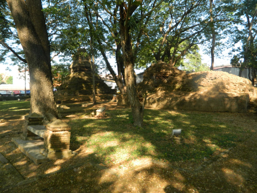
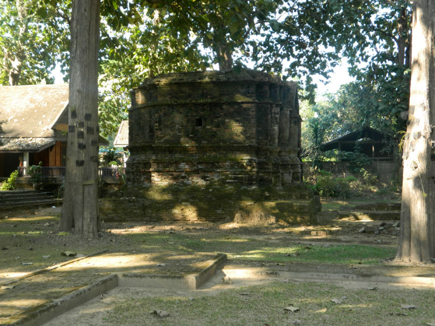
| Wat Phra That Pu Khao |
16F |
Temple ruin |
8th century, probably reconstructed 14th century |
Sob Ruak, Chiang Saen District |
Google Map |
26 Dec 2016 |
--- |
temple consists of a viharn and a mondrop (shrine of the Buddha) surrounded by 3 satellite chedis (E,3,15m) |
| Wat Phra Yeun |
16F |
Temple ruin |
14th century |
Chiang Saen |
Google Map |
27 Dec 2016 |
--- |
legend states that Wat Phra Yeun was built by the son of Phaya Saenphoo, Phaya Khamfoo in 1331 for keeping Buddha relics. It was ordered to be rebuilt in 1638....to date only the chedi can be found (E,3,10m) |
| Wat Phrathat Doi Tung |
16F,24E |
Buddhist Temple |
10th century |
Mae Fa Luang District |
Google Map |
24 Dec 2016,14 Feb 2024 |
donations welcome |
(Difficult-Chiang Rai 56.7kms,Excellent,30 mins).....Amazing Thailand |
| Wat Phuok Phan Tong |
16F |
Temple ruin |
no later than 16th century |
Chiang Saen |
Google Map |
27 Dec 2016 |
--- |
temple has only dating evidence from the 16th century....when the Burmese invaded in 1774, legend states that the monk Khru Ba asked for peace in the city then after Lanna attacked in 1804, it is claimed that the people paraded through the temple to resettle in Chiang Mai (E,4,15m) |
| Wat Phra That Mae Chedi |
24E |
Buddhist Temple |
20th Century |
Mae Chedi Mai, Wiang Pa Pao District |
Google Map |
13 Feb 2024 |
donations welcome |
(Difficult,Amazing,30-60m)..... The temple museum was established by Phra Kru Phaiboon Phatthanaphirak (Thawan Parak-kamo) who put together this amazing collection from three main sources: more. |
| Wat Phrathat Doi Khao Kwai |
24E |
Buddhist Temple |
11th Century? |
Rop Wiang, Mueang Chiang Rai District |
Google Map |
15 Feb 2024 |
donations welcome |
(Easy-Chiang Rai 6.3km,V.Good,20 minutes).....www.lovethailand.org |
| Wat Prachao Lanthong |
16F |
Temple ruin |
unknown |
Chiang Saen |
Google Map |
27 Dec 2016 |
--- |
located in the middle of the city, the temple contains ancient monuments including the bell shaped chedi and two Buddha images from ancient times, mentioned in the Yonok chronicle named Prachao Lanthong and Prachao Thongthip (E,3,15m) |
| Wat Roi Kho |
16F |
Temple ruin |
16th century |
Chiang Saen |
Google Map |
27 Dec 2016 |
--- |
a temple with no recorded history....the chedi consists of a square base supporting a chamber above which is an octagonal shapped stupa....the viharn lies to the east and has solid brick walls with a pedestal supporting a limed Buddha image of Lanna and Chiang Saen art (E,3,10m) |
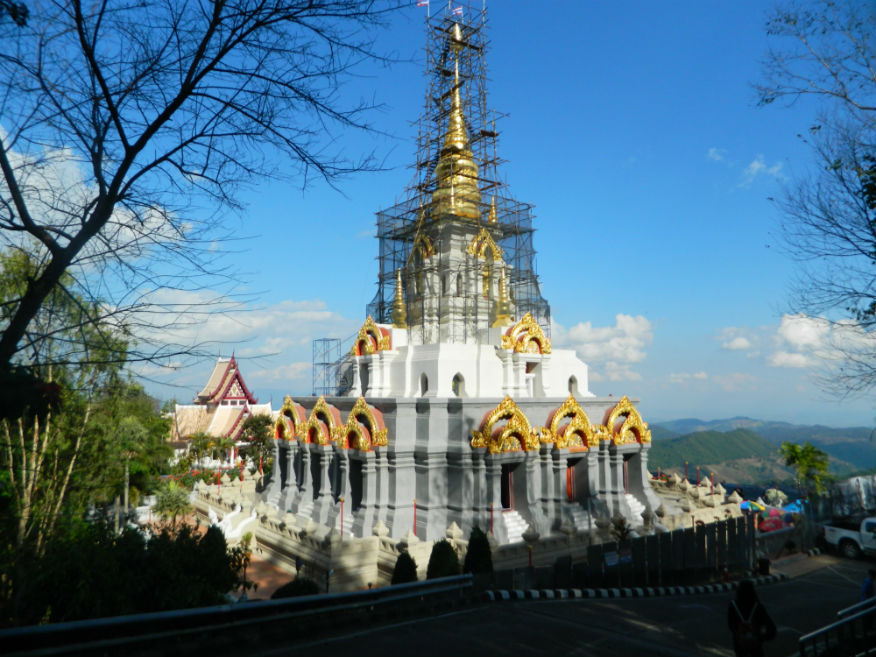
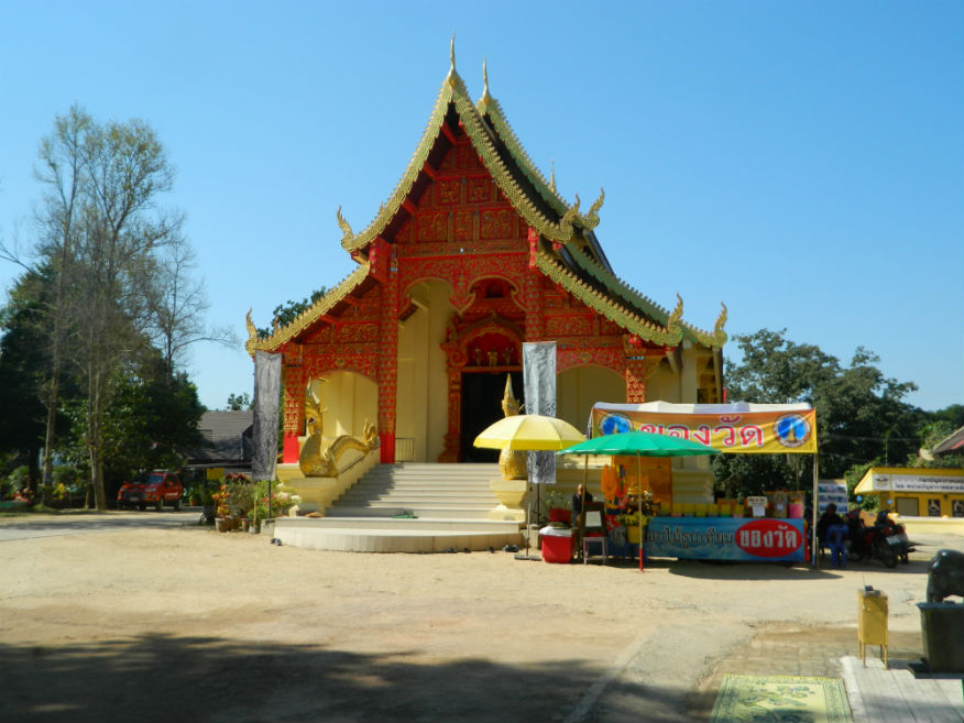
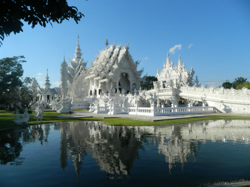
| Wat Rong Khun (White Temple) |
16F |
Buddhist Temple |
1998 |
Mueang Chiang Rai District |
Google Map |
21 Dec 2016 |
accepts donations |
arguably the most impressive structure in northern Thailand, better known to foreigners as the White Temple, it is a contemporary, unconventional, privately-owned art exhibit in the style of a Buddhist temple....was designed and built by artist Chaloemchai Khositphiphat (M,5,2h) |
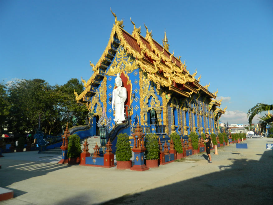
| Wat Rong Suea Ten |
16F |
Buddhist Temple |
2005 |
Mueang Chiang Rai District |
Google Map |
22 Dec 2016 |
accepts donations |
temple gets it’s name, (suea=tiger), from the beasts that roamed here when the area was a wilderness....the monastery was established in 2005 in 6 acres of land and is adorned with exquisite blue and gold (E,4,30m) |
| Wat Sam Mum Muang |
16F |
Temple ruin |
unknown |
Sob Ruak, Chiang Saen District |
Google Map |
26 Dec 2016 |
--- |
temple has a moat but there is no provenance for its construction... in 2005/6 excavation revealed a few votive tablets...another temple with excellent views of the Mekong River (E,3,15m) |
| Wat Sangkha Kaeo Don Tan |
16F |
Temple ruin |
from 7th century |
Chiang Saen |
Google Map |
26 Dec 2016 |
--- |
consisting of a chedi and a viharn facing east, there has been a temple here since 639 according to Yonak Chronicle 61....additions have been made through until the 16th century (E,4,20m) |
| Wat Song Pee Nong |
16F |
Temple ruin |
pre 13th century |
south of Chiang Saen |
south of the city |
26 Dec 2016 |
--- |
legend has it that this was a holding camp for the King of Saen Pu while he was surveying for the site of the new city....the site has chedis, a viharn, a stupa and sala....the chedi is in Lanna style, 14th-15th Century (M,4,20m) |
| Wat Tham Phra (Buddha Cave Temple) |
24E |
Cave Temple |
not stated |
Rop Wiang, Mueang Chiang Rai District |
Google Map |
15 Feb 2024 |
donations welcome |
(Easy-Chiang Rai 8.9km,Locally Important,20 minutes).....inthailand.wiki |
| Wat That Khieo |
16F |
Temple ruin |
pre 13th century |
south of Chiang Saen |
Google Map |
26 Dec 2016 |
--- |
temple consists of a bell-shaped chedi and an east-facing viharn with minor monuments built during Burmese occupation (M,3,15m) |
| Wat That Khong |
16F |
Temple ruin |
pre 13th century |
south of Chiang Saen |
Google Map |
26 Dec 2016 |
--- |
located to the south of the city lying in an area known as Chiang Saen Noi (Wieng Preuksa) which predates Chiang Saen...the site seems to have been disturbed likely through the road construction (M,3,10m) |
| Wat Wiang Ka Long |
19B |
Ancient Town |
Pre-history |
Wang Pao District |
Google Map |
14 May 2019 |
n/a |
(E,3,45m).....Learn |
| Wat Wiang Ka Long |
19B |
Buddhist Temple |
complex on ancient site |
Wang Pao District |
Google Map |
14 May 2019 |
accepts donations |
(E,3,45m).....Learn |
| Yang-thung Gate/Fort |
16F |
City Gate ruin |
unknown |
Chiang Saen |
south city |
27 Dec 2016 |
--- |
one of the northern gates....consistes of a horsehoe shaped defensive wall, long enough to enclose a small garrison....the wall is surrounded by a moat (E,3,10m) |
