Tours Section by Province |
| Name |
Ref. |
Description |
Era |
District/Province |
Location |
Date visited |
Price (baht) |
Rating/Comment |
| Chanthaburi Province |
| Amazing Stone |
24Oct |
Local Attraction |
Ancient |
Sak Thai, Khao Khitchakut District |
Google Map |
15 Oct 2024 |
none |
(Moderate - Chanthaburi City,18.3km,Curious,10 minutes)..... A large boulder coming to rest by the roadside has been turned into a shrine. |
| Ao Kung Kraben |
16A |
Bay |
|
Tha Mai District |
Google Map |
24 June 2016 |
----- |
a sanctuary for marine and bird life surrounded by mangrove (M,4,2h) |
| Ban Koh Meow |
16A |
Village |
not stated |
Laem Sing District |
Google Map |
28 Jun 2016 |
n/a |
coastal village with a headland and island offshore....home to descendants of Vietnamese migrants (M,2,30m) |
| Ban Koh Proet |
16A |
Sub District |
not stated |
Laem Sing District |
Google Map |
28 Jun 2016 |
n/a |
coastal town with a headland and islands offshore....home to descendants of Vietnamese migrants (M,2,1hr) |
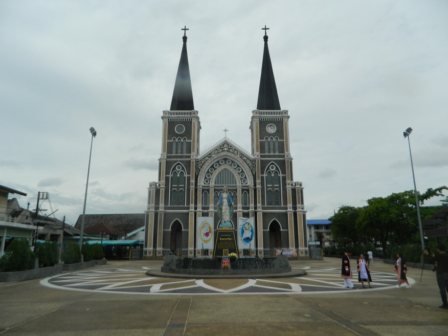
| Cathedral of Mary Immaculate Conception |
16A |
Catholic Church |
1909 |
Mueang Chanthaburi |
Google Map |
29 Jun 2016 |
accepts donations |
construction begun during French occupation (1893-1904)....built in gothic style (E,4,1h) |
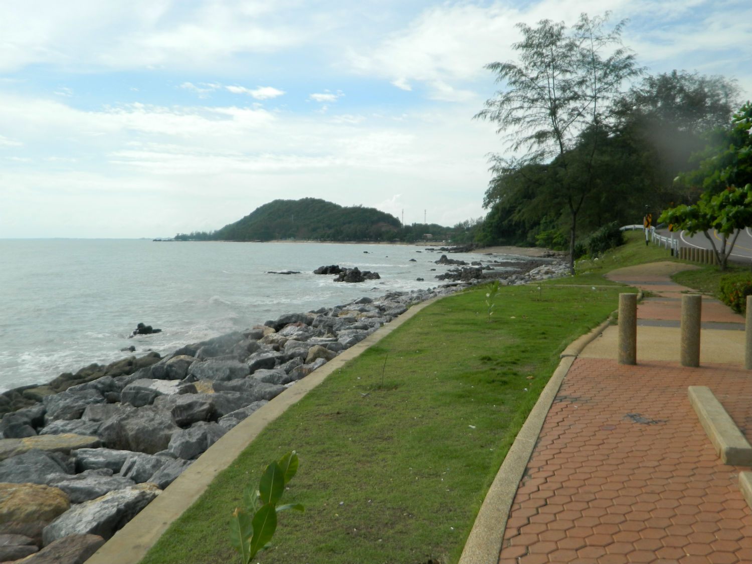
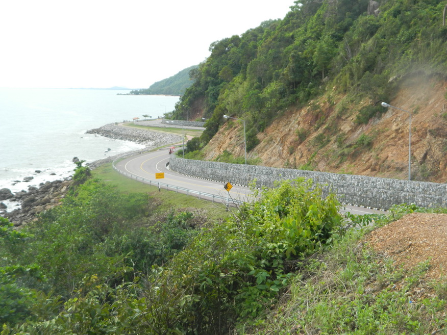
| Chaloem Burapha Chonlathit Road |
16A |
Road |
not stated |
Rayong, Chanthaburi and Trat Provinces |
Eastern Gulf of Thailand |
23-29 Jun 2016 |
n/a |
more than 100 kilometers long lying in parallel with the beach through the city centre of Rayong, Chanthaburi and Trat Provinces (E,4,1d+) |
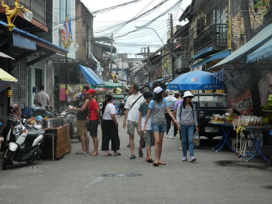
| Chanthaboon Waterfront Community |
24Oct |
Community |
Ayutthaya |
Chanthaburi, Mueang Chanthaburi District |
Google Map |
15 Oct 2024 |
none |
(Easy - in Chanthaburi City,Excellent,30-60 minutes)..... Waterfront community for dining/shopping....Wikipedia |
| Chantaburi Gems and Jewelry Centre |
16A,24Oct |
Jewelry Centre and Museum |
not stated |
Mueang Chanthaburi |
Google Map |
26 Jun 2016,16 Oct 2024 |
n/a |
(Easy - in Chanthaburi City,Excellent,1 hour)..... Important international trade centre with inforamative museum.... facebook.com |
Chanthaburi Grand Canyon
|
26Jan |
Canyon |
n/a |
Mueang Chanthaburi |
Google Map |
27 Jan 2026 |
none |
(Moderate - Chanthaburi, 11.9 km, no rail services to Chanthaburi - Quite picturesque but not more than 15 minutes needed here).....Grok search |
| Chanthaburi Old City and Gems Quarter |
16A |
City |
not stated |
Mueang Chanthaburi |
Google Map |
26 Jun 2016 |
n/a |
a significant heritage site in Thailand with an interesting history from the days of Taksin the Great through the Pakman crisis of 1893 (E,4,1d) |
| Chanthaburi River |
16A,24Oct |
River |
n/a |
Mueang Chanthaburi and Laem Sing Districts |
Google Map |
26 Jun 2016,16 Oct 2024 |
none |
(Excellent)..... Scenic views from the city to the river mouth..... Wikipedia |
| City Pillar Shrine |
16A |
Shrine |
1767 |
Mueang Chantaburi |
Google Map |
26 June 2016 |
free |
shrine of the City Guardian Spirit believed to have been built King Taksin after his conquest over the Burmese (E,4,15m) |
| Crab Fossil Museum |
23O |
Museum |
not stated |
Krachae, Na Yai Am District |
Google Map |
9 Nov 2023 |
n/a |
(Awkward - Chanthaburi 42.9km,Limited Interest,10m).....Small hall where mainly crab fossils are kept in show cases and in a pit in the middle of the hall |
| Fisherman's Village |
16A |
Village |
not stated |
Na Yai Am District |
Google Map |
25 Jun 2016 |
n/a |
village near Noen Nang Phraya with views across to Chao Lao Beach (M,4,20m) |
| Kep Tawan Beach |
16A |
Bay |
|
Tha Mai District |
Google Map |
24 June 2016 |
----- |
stoney beach near Noan Nang Phraya (M,3,10m) |
| Khaem Nu River |
16A |
River |
|
|
Google Map |
27 June 2016 |
----- |
rises in the Chanthaburi mountain range (E,3,30m) |
| Khao Khitchakut National Park |
24Oct |
National Park |
Ancient |
Pluang, Khao Khitchakut District |
Google Map |
15 Oct 2024 |
200 |
(Moderate - Chanthaburi City,36.3km,Outstanding,All Day)..... The park is popular for annual pilgrimage to Buddha Footprint at Khao Phra Bat, it’s waterfalls and hiking....thainationalparks.com |
| Khao Laem Sing Forest Park |
16A |
Park |
|
Laem Sing District |
Google Map |
27 June 2016 |
200 |
curious pink rock formations presumably caused by oxides....one for a geologist to work out (M,4,1h+) |
| Khlung Seafood |
23O |
Seafood Restaurant |
n/a |
Khlung District |
Google Map |
8 Nov 2023 |
menu |
(Moderate - Chanthaburi 28.3km,Excellent,30-60m).....Popular seafood restaurant on the Wan Yao River. |
| Khuan Phluang |
24Oct |
Reservoir |
n/a |
Pluang, Khao Khitchakut District |
Google Map |
15 Oct 2024 |
none |
(Moderate - Chanthaburi City,29.5km,Peaceful/Remote,15 minutes)..... This small reservoir measuring 2.4 km across, in the foothills of Khao Khitchakut is retained by an earth and rock dam. |
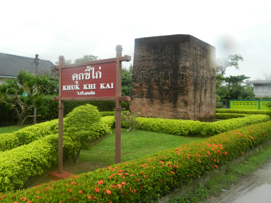
| Khuk Khi Kai |
16A |
Prison |
late 19th Century |
Paknam Leam Sing, Leam Sing District |
Google Map |
27/28 June 2016 |
free |
built to hold Thais who were against the French occupation (M,4,30m) |
| Site of King Taksin Shipyard |
16A |
Historic Shipyard |
c.1767 |
Nong Bua, Mueag Chanthaburi District |
Google Map |
29 June 2016 |
free |
site of King Taksin's shipyard from where he was able to assemble a fleet to defeat the Burmese (M,4,30m) |
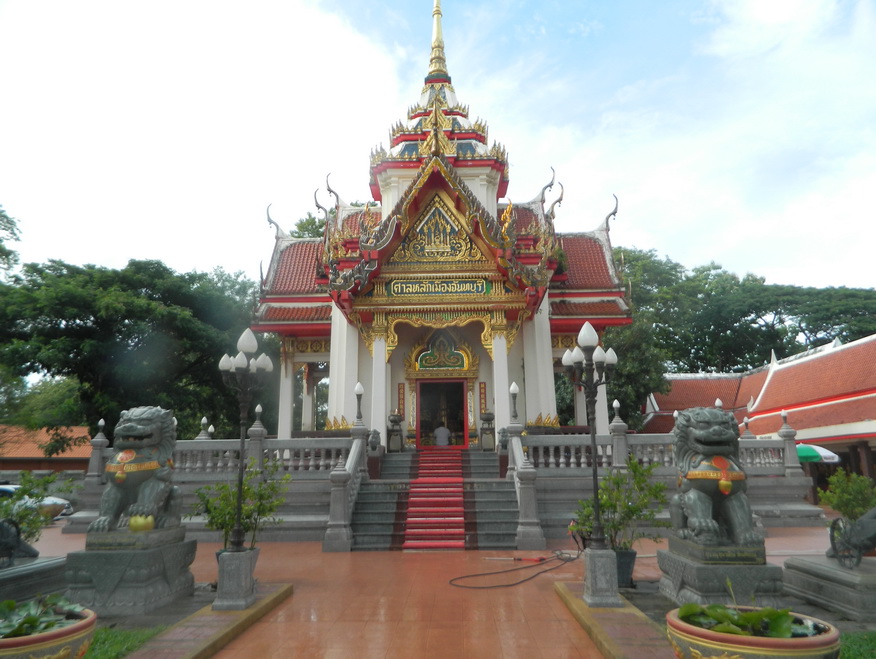
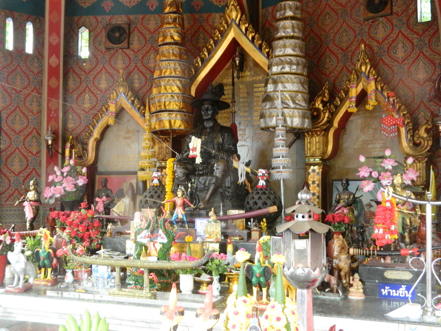
| Shrine of King Taksin the Great |
16A |
Shrine |
not stated |
Mueang Chantaburi |
Google Map |
26 June 2016 |
free |
structure topped by a roof designed to look like the round brimmed hat that Taksin was known for wearing while riding into battle (E,4,15m) |
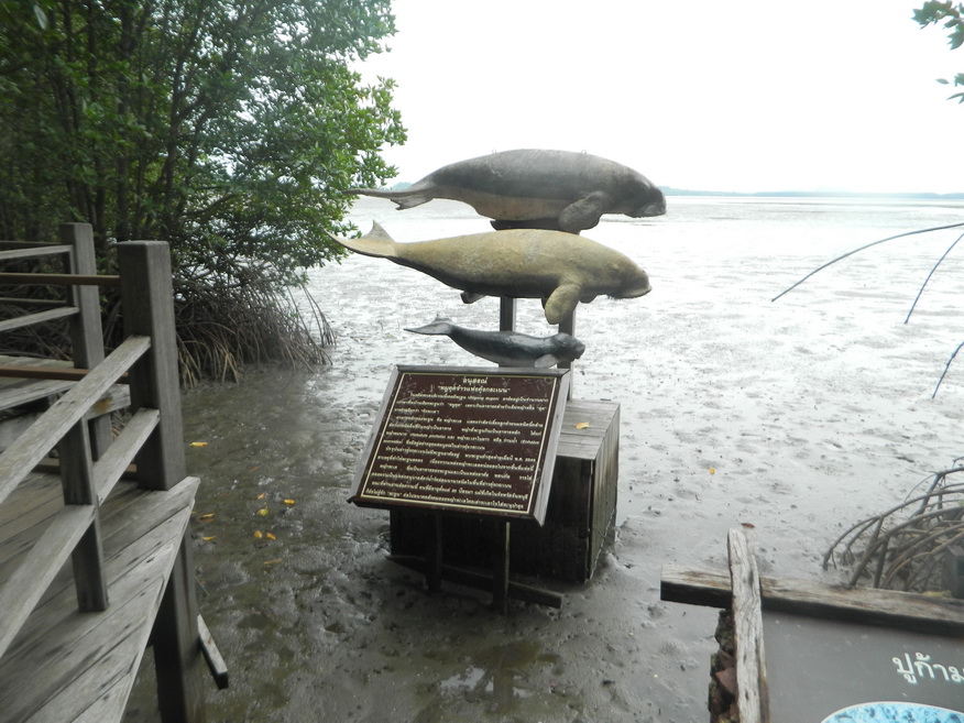
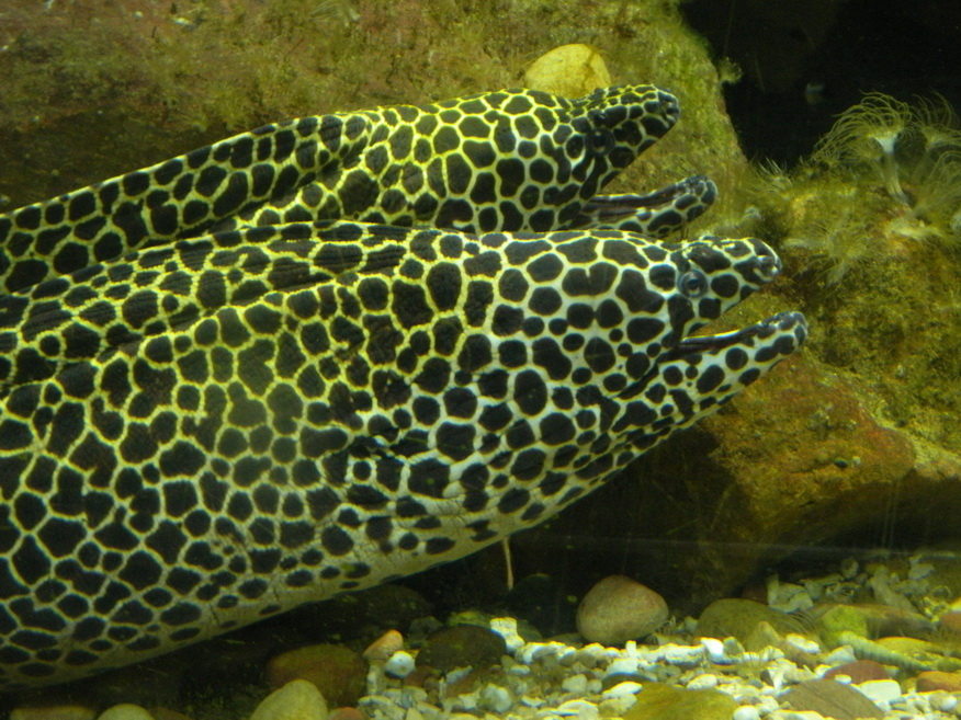
| KKB Aquarium |
16A |
Aquarium |
|
Ao Krung Kraben, Tha Mai District |
Google Map |
26 June 2016 |
free |
not one of the biggest aquariums but there is a good selection of marine life on view including a main tank for larger fish with the usual visitor tunnel underneath (M,4,1h) |
| Kung Krabaen Wildlife Sanctuary (Pink Stone) |
16A |
Park |
|
Tha Mai District |
Google Map |
27 June 2016 |
200 |
curious pink rock formations presumably caused by oxides....one for a geologist to work out (M,4,1h+) |
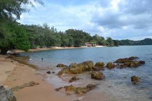
| Kung Wiman Beach |
16A |
Beach |
|
Na Tai Am District |
Google Map |
24 June 2016 |
none |
small but attractive golden sand beach to the west of Ao Kung Kraben (M,4,1h) |
Kwian Hak Pier
|
26Jan |
Pier |
n/a |
Khlung |
Google Map |
30 Jan 2026 |
tip the boatman if going to Farm Pu Nim Restaurant |
(Moderate - Chanthaburi, 28.2 km, no rail services to Chanthaburi - A very pleasant boat trip is needed from Kwian Hak to reach Farm Boo Nim Restaurant if needed).....Grok search |
| Laem Sing |
16A |
Headland |
|
Laem Sing District |
Google Map |
27 June 2016 |
----- |
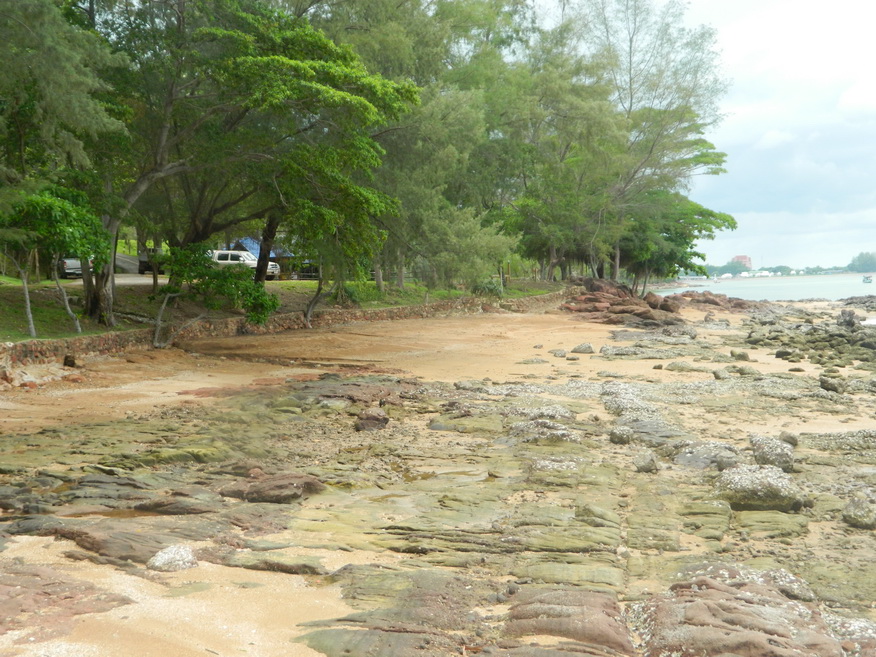
Laem Sing is the headland on the western side of the Wang Ta Not estuary and from which the district gets its name....'laem' in Thai mean headland while sing (lion) refers to the shape of a rock stack at the end of the headland (M,4,2-3h) |
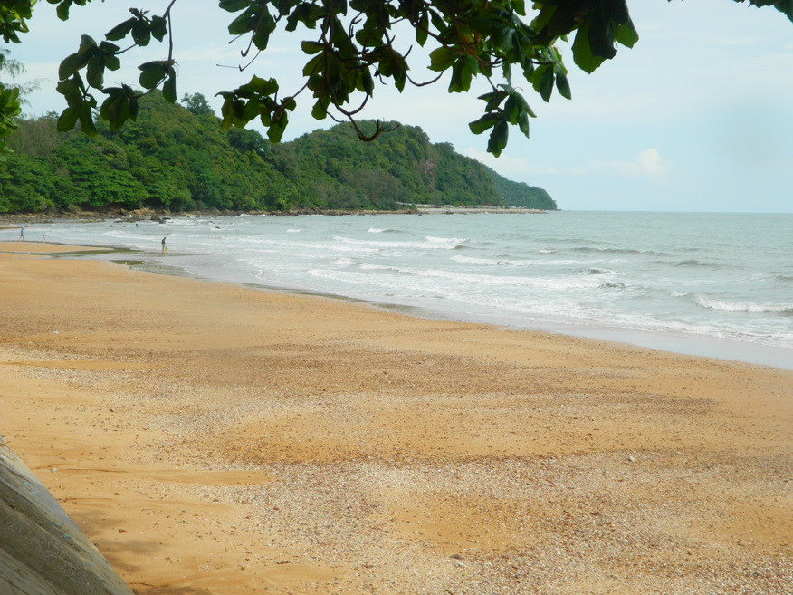
| Laem Sing Beach |
16A |
Beach |
|
Laem Sing District |
Google Map |
27 June 2016 |
----- |
popular beach from Paknam Leam Sing running southeast (E,4,1d) |
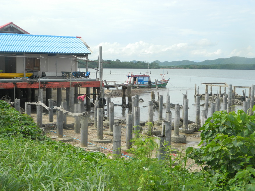
| Laem Sing Fishing Port |
24Oct |
Port |
n/a |
Pak Nam, Laem Sing District |
Google Map |
16 Oct 2024 |
none |
(Moderate - Chanthaburi City,23.6km,Excellent,30 minutes)..... Come here to watch the fishing boats arrive and land their catch. |
| Muang Paniat Archaeological Site |
24Oct |
Archaeological Site |
Khmer |
Khlong Narai, Mueang Chanthaburi District |
Google Map |
15 Oct 2024 |
none |
(Easy - Chanthaburi City,6.4km,Hidden Gem,20-30 minutes)..... It is assumed that this is where the city of Chanthaburi was founded.....lovethailand.org |
| Nampu Market |
24Oct |
Market |
unknown |
Wat Mai, Mueang Chanthaburi District |
Google Map |
16 Oct 2024 |
none |
(Moderate - Chanthaburi City,23.6km,Excellent,30 minutes)..... Good variety of fresh fruit and vegetables seafood available as well as dry goods. |
| Namtok Krathing (Krathing Waterfall) |
24Oct |
Waterfall |
n/a |
Pluang, Khao Khitchakut District |
Google Map |
15 Oct 2024 |
200 |
(Moderate - Chanthaburi City,33.3km,not reviewed)..... thailandvisitorinfo.com |
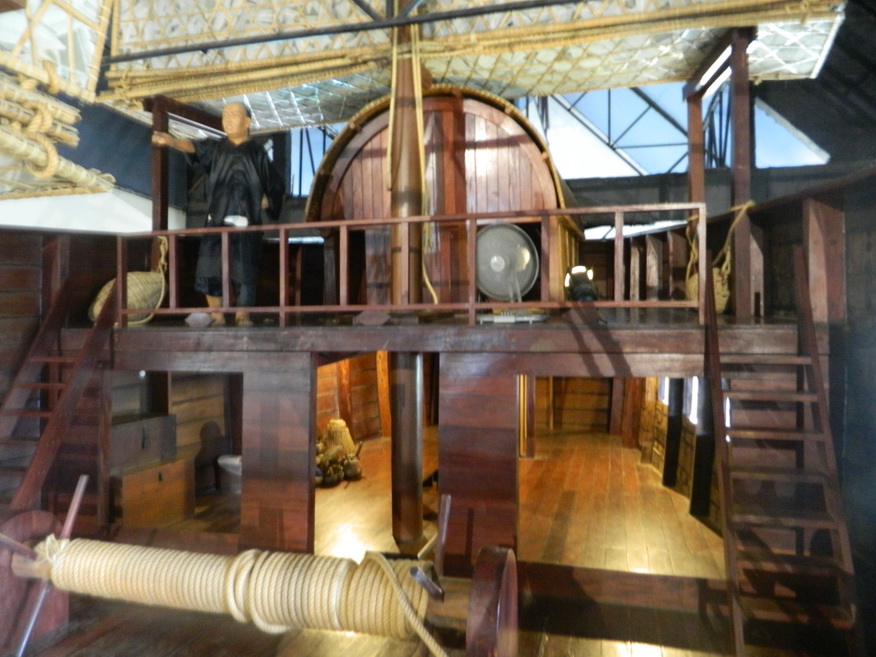
| National Maritime Museum |
16A |
Museum |
various |
Mueang Chanthaburi District |
Google Map |
29 June 2016 |
100 |
important museum outlining Thailand's naval history both military and civil....centre for the preservation of object recovered from sunken wrecks (M,4,1h+) |
| Noen Nang Phraya |
16A |
Coastline |
|
Tha Mai District |
Google Map |
24 June 2016 |
----- |
rocky coastline with a viewpoint popular with tourists (M,4,1h) |
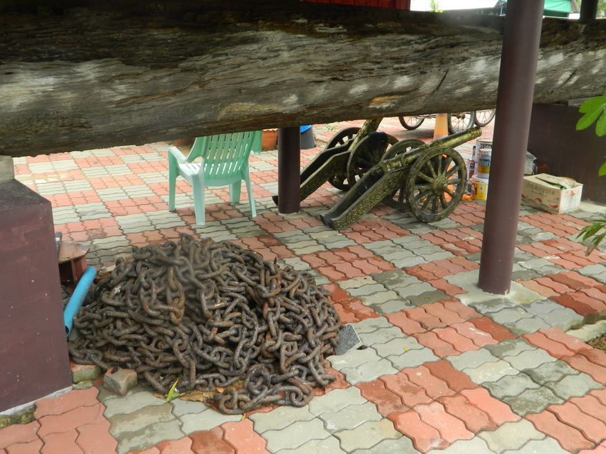
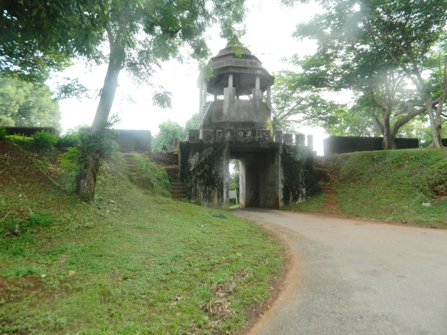
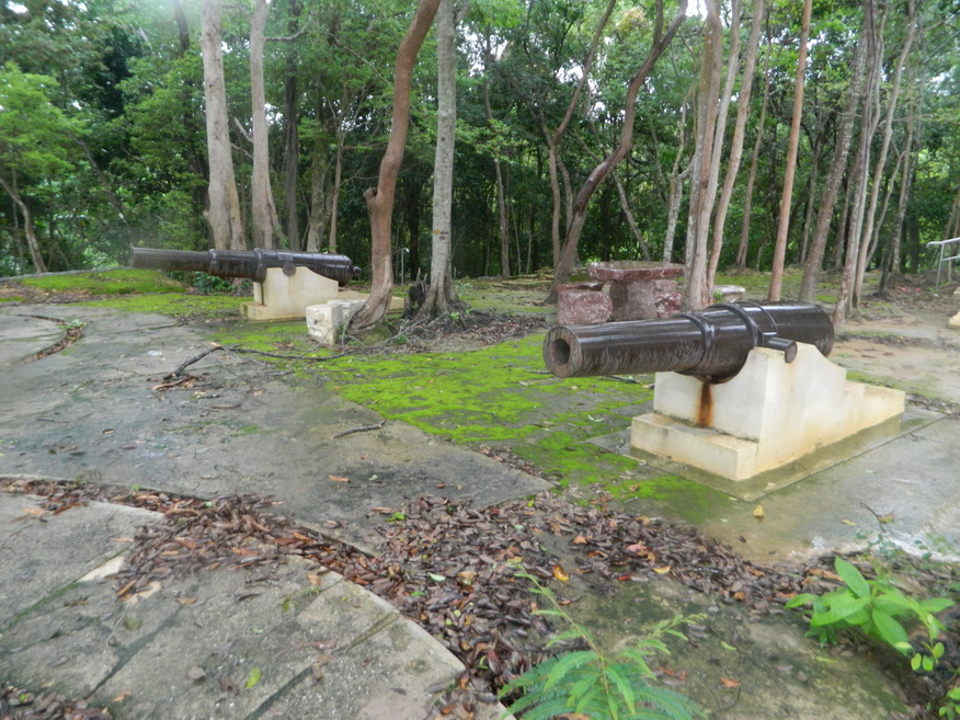
| Noen Wong Fortress |
16A |
Fortress |
1834 |
Mueang Chantaburi District |
Google Map |
26 June 2016 |
free |
built by King Rama III during hostilities with the Vietnamese....the brick walls surrounded by a moat support 39 cannon still in situ dating back as far as 1789 (M,4,30m) |
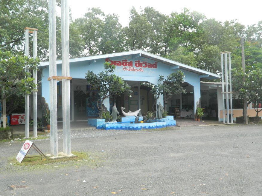
| Oasis Sea World |
16A |
Tourist Attraction |
|
Paknam Leam Sing, Leam Sing District |
Google Map |
29 June 2016 |
----- |
performing dolphins leap through hoops & swim alongside guests at this lively marine park (E,?,?h) |
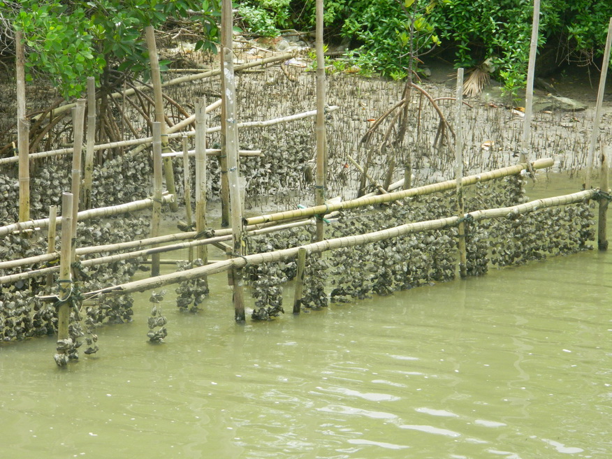
| Oyster beds |
16A |
Shellfish Farm |
|
Paknam Leam Sing, Leam Sing District |
Google Map |
29 June 2016 |
----- |
interesting distraction from general touring (E,3,15m) |
| Pairi Phinat Fort |
16A |
Fortress |
late 19th Century |
Leam Sing District |
Google Map |
27 June 2016 |
free |
constructed by King Rama III in an atempt to deter the French (M,4,30m) |
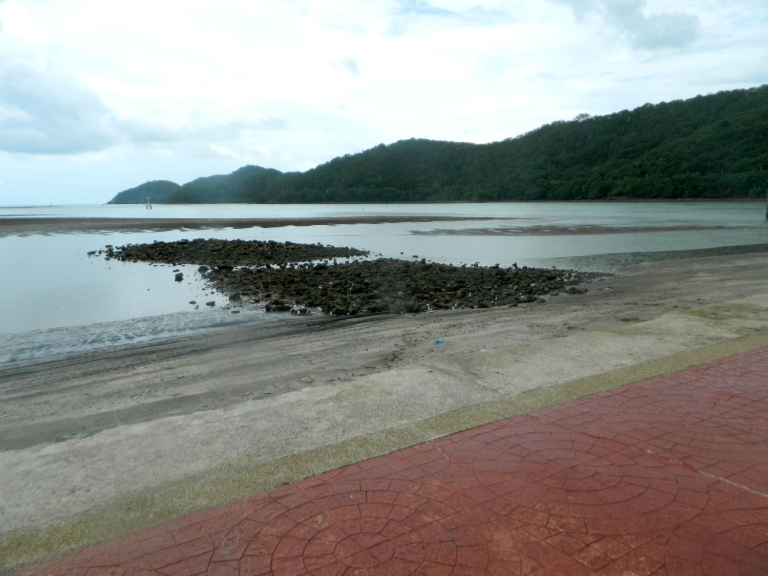
| Pak Nam Rat/Pak Nam Khaem Nu Viewpoint |
16A |
Viewpoint |
|
Tha Mai District |
Google Map |
27 June 2016 |
----- |
viewpoint at the estuary of the Kaem Nu River (E,3,30m) |
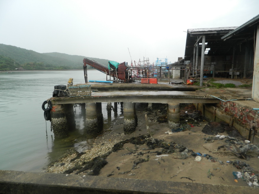
| Plai Chan Pier |
23O |
Pier |
n/a |
Khlung District |
Google Map |
8 Nov 2023 |
n/a |
(Moderate - Chanthaburi 28.1km,Good).....Local boat pier on the edge of the mangrove. |
| Pu Nim Restaurant |
19D |
Restaurant |
---- |
Wan Yao Estuary, Khlung District |
Google Map |
5 June 2019 |
per menu |
(M,4,1+h).....Learn |
| Tap Lae Beach |
16A |
Beach |
|
Na Yai Am District |
Google Map |
24 June 2016 |
----- |
quiet in low season, presently underdeveloped (M,4,1h) |
| Tuek Daeng |
16A,24Oct |
Historical Building |
1893 |
Paknam Leam Sing |
Google Map |
27/28 June 2016,16 Oct 2024 |
none |
(Moderate - Chanthaburi City,23.4km,Historic,20 minutes)..... Built by the French as their headquarters during the occupation....Amazing Thailand |
| Waan Yao Estuary |
19D |
Estuary |
|
Khlung District |
Google Map |
5 June 2019 |
boat is free for the restaurant |
(M,4,30+++m).....Learn |
Wang Suan Ban Kaeo
|
26Jan |
Palace |
post WWII |
Mueang Chanthaburi |
Google Map |
27 Jan 2026 |
none |
(Easy - Chanthaburi, 6.9 km, no rail services to Chanthaburi - Historically important, residence of former Queen Rambhai Barni, allow an hour).....Grok search |
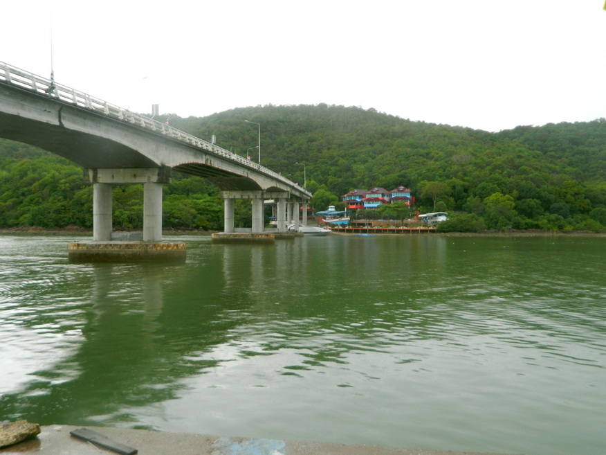
| Wang Ta Not River |
16A |
River |
|
Tha Mai District and others |
Google Map |
27 June 2016 |
----- |
rises in the Chanthaburi mountain range (E,3,30m) |
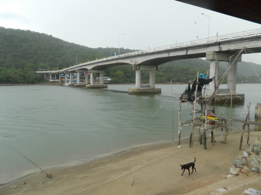
| Wang Ta Not River Bridge |
16A |
Bridge |
not stated |
Tha Mai District |
Google Map |
27 Jun 2016 |
n/a |
bridge carrying the Chaloem Burapha Chonlathit across the Wang Ta Not River (E,3,20m) |
| Wat Bot Muang |
24Oct |
buddhist Temple |
n/a |
Wat Mai, Mueang Chanthaburi District |
Google Map |
15 Oct 2024 |
donations welcome |
(Easy - in Chanthaburi City,Worth a Look,15 minutes)..... This is a serene and quaint temple situated at the entrance to the old Chanthaboon market community....wanderlog.com |
| Wat Krathing |
24Oct |
Buddhist Temple |
Ancient |
Pluang, Khao Khitchakut District |
Google Map |
15 Oct 2024 |
donations welcome |
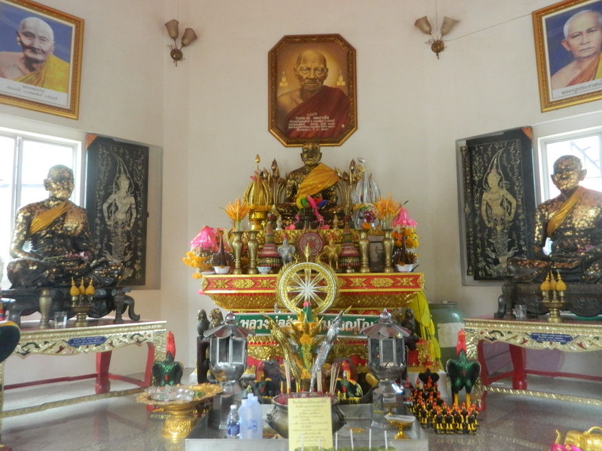
(Moderate - Chanthaburi City,30.4km,Locally Important,20 minutes)..... Here there is the mausoleum of the revered monk Luang Pu Thian. It's also a departure point for Khitchakut Mountain. |
| Wat Paknamleamsing |
16A |
Buddhist Temple |
not stated |
Leam Sing District |
Google Map |
29 Jun 2016 |
accepts donations |
dedicated to a man, Luang Por Soon, a monk of the village of Pak Nam Leam Sing who helped descendants from French and Vietnamese soldiers who saw something virtuous in him (E,3,20m) |
| Wat Phai Lom (Royal Monastery) |
24Oct |
Buddhist Temple |
Early Rattanakosin |
Chanthanimit, Mueang Chanthaburi District |
Google Map |
15 Oct 2024 |
donations welcome |
(Easy - Chanthaburi City,3.6km,Worth a Look,20-30 minutes)..... Temple housing a large reclining Buddha image. Some buildings are over 200 years old....thailandtourismdirectory |
| Wat Phluang Khao Khitchakut |
24Oct |
Buddhist Temple |
Ancient |
Pluang, Khao Khitchakut District |
Google Map |
15 Oct 2024 |
donations welcome |
(Moderate - Chanthaburi City,30.4km,Limited Interest,15 minutes)..... This temple is unremarkable but does have some interesting memorabilia, From here you can take transport to Khitchakut Mountain. |
| Wat Thong Thua |
24Oct |
Buddhist Temple |
Khmer |
Phlap Phla, Mueang Chanthaburi District |
Google Map |
15 Oct 2024 |
donations welcome |
(Easy - Chanthaburi City,5.9km,Worth a Look,20-30 minutes)..... Ancient Khmer sculptures such as lintels and sandstone door columns have been found here....Amazing Thailand |
| Wat Yothanimit |
16A |
Buddhist Temple |
1830's |
near Noen Wong Fort, Mueang Chanthaburi District |
Google Map |
29 Jun 2016 |
accepts donations |
constructed at the same time as the fort (M,3,15m) |
Welu Wetland
|
26Jan |
Wetland |
n/a |
Khlung |
Google Map |
30 Jan 2026 |
none |
(Difficult - Chanthaburi, 44.9 km, no rail services to Chanthaburi - There are poor roads in this area. You need a good reason to enter the wetland).....Grok search |
