
Day 12, Tuesday 11 April - Na Pho Klang
Not Recommended....... Pool Villa has been a good location to continue our travels and enter one of the most picturesque districts in the province. The bed is really comfortable but oh dear! In other situations, we would have to rejected it. It's certainly the most poorly maintained accommodation so far on this tour. The bathroom, is a complete wreck, and the lack of workspace means our belongings are cluttered all over the floor.
Well, an advantage of persevering is that we can retrace our steps and enter Pha Taem National Park from the north which would really be impractical if we had continued to Khong Chiam.
Pha Taem National Park....... Pha Taem National Park covers an area of 340 square kilometres, where plateaus and hills dominate the parks landscape. There are sheer cliffs, which resulted from earthquakes. Most trees belong to the deciduous dipterocarp forest. Irregular shaped sandstone is found scattered throughout the area. The park covers the districts of Khong Chiam, Sri Mueang Mai, and Pho Sai, all adjacent to Laos PDR with the Mekong River as the border. The Pha Taem National Park Office is located at Ban Nong Phue Noi, Huai Phai sub district, Khong Chiam district. The general geography of the park consists of a plateau and hills. There are also steep cliffs caused by the separation of the Earth’s surface. There are beautiful flowering plants growing on the stony ground after the rains.
The park can be entered from several directions and today we retrace our steps back to Pho Sai district which is the most northerly of the three districts the park occupies.
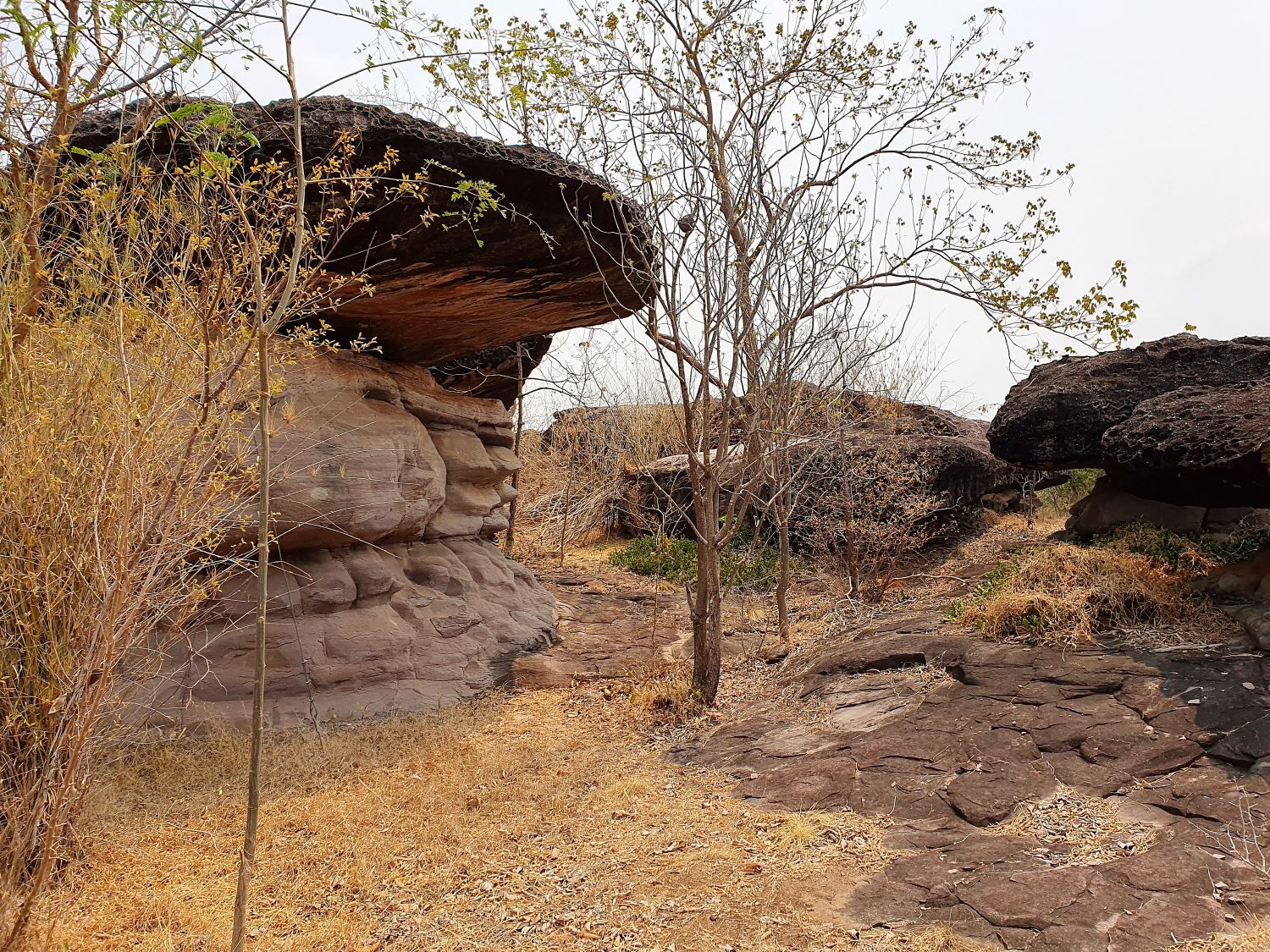
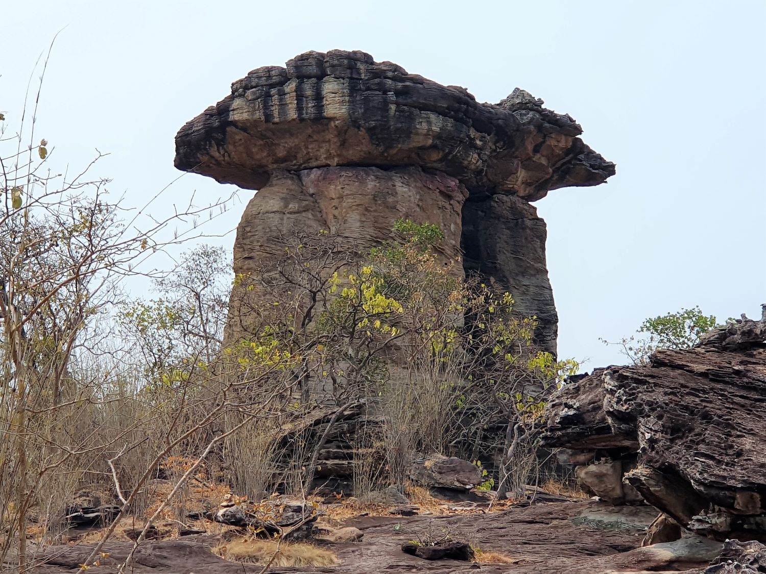
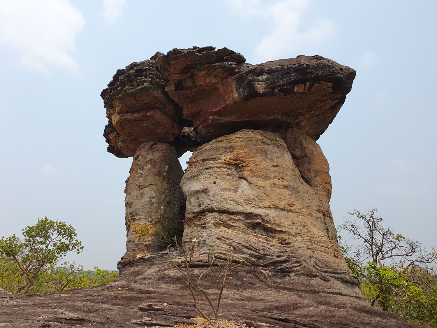
Giant Rock Pillar....... The Giant Rock Pillar, Sao Chaliang Yai in Thai, is located a few kilometres from rural road 2112 at Samrong. This giant rock pillar is a prime example of many featured in the park. The process that created them is the same. The sandstone rock bed was influenced by external forces or have been caused by the expansion and contraction when the weather was hot during the day and cold at night. Cracks and joints developed in the sandstone bed. The size of these cracks and joints depends on external forces and where they are weak, they are easily eroded. Later, these cracks become wider caused by both vertical and horizontal erosion to the bed rock. Sandstone which is normally strong will be eroded little by little. The eroded parts are then destroyed and washed away while the hard parts remain creating monolithic rock pillars.
We now proceed just a couple of kilometres more and reach the mighty Mekong River.
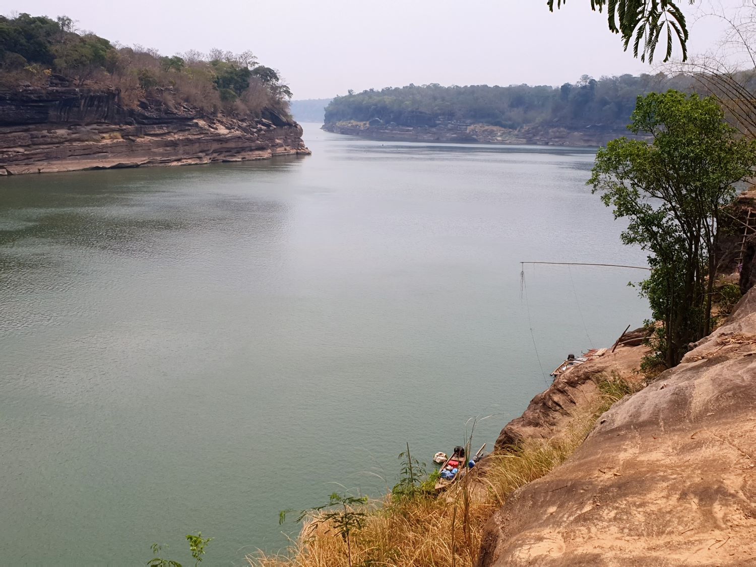
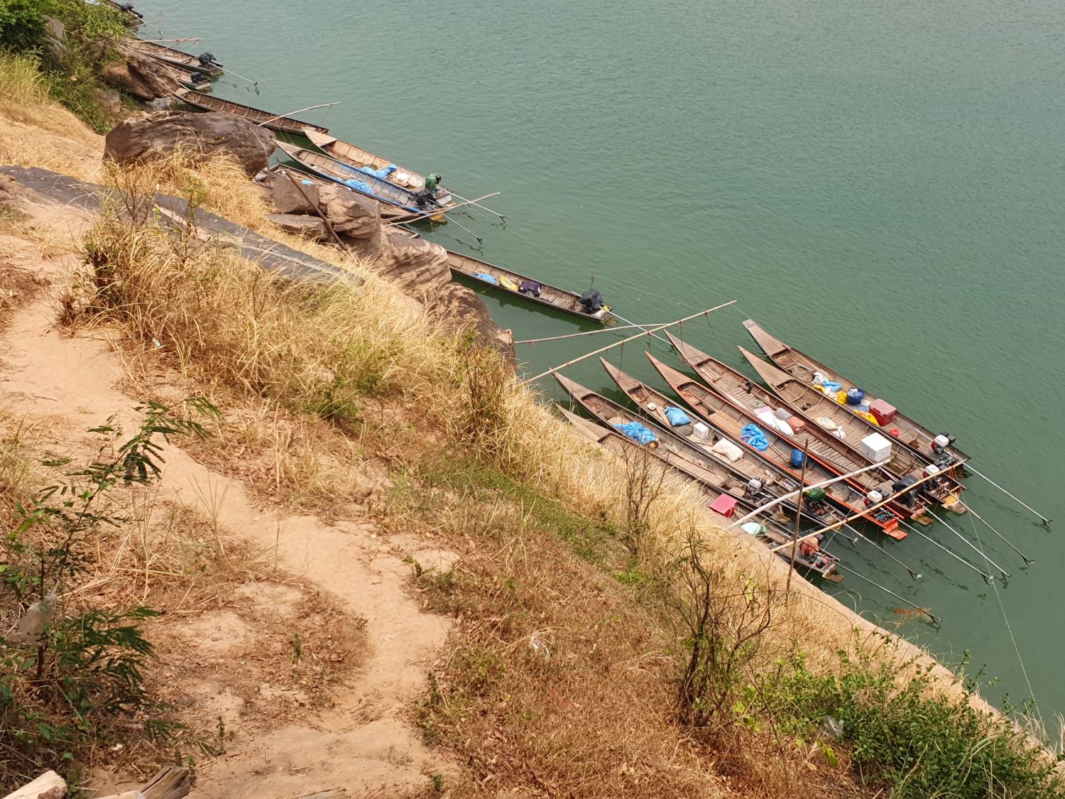
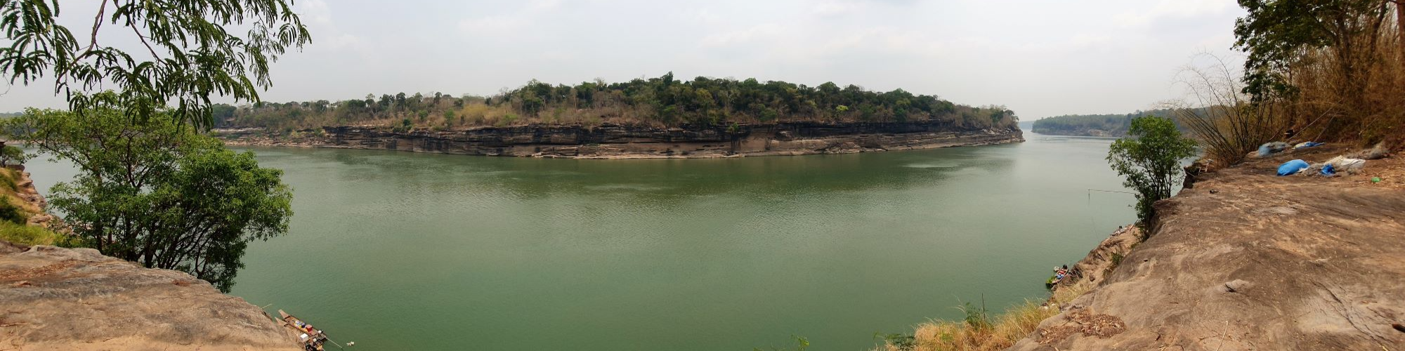
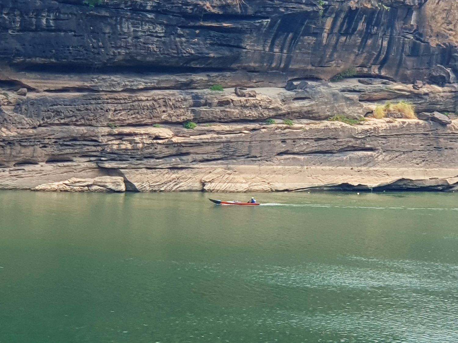
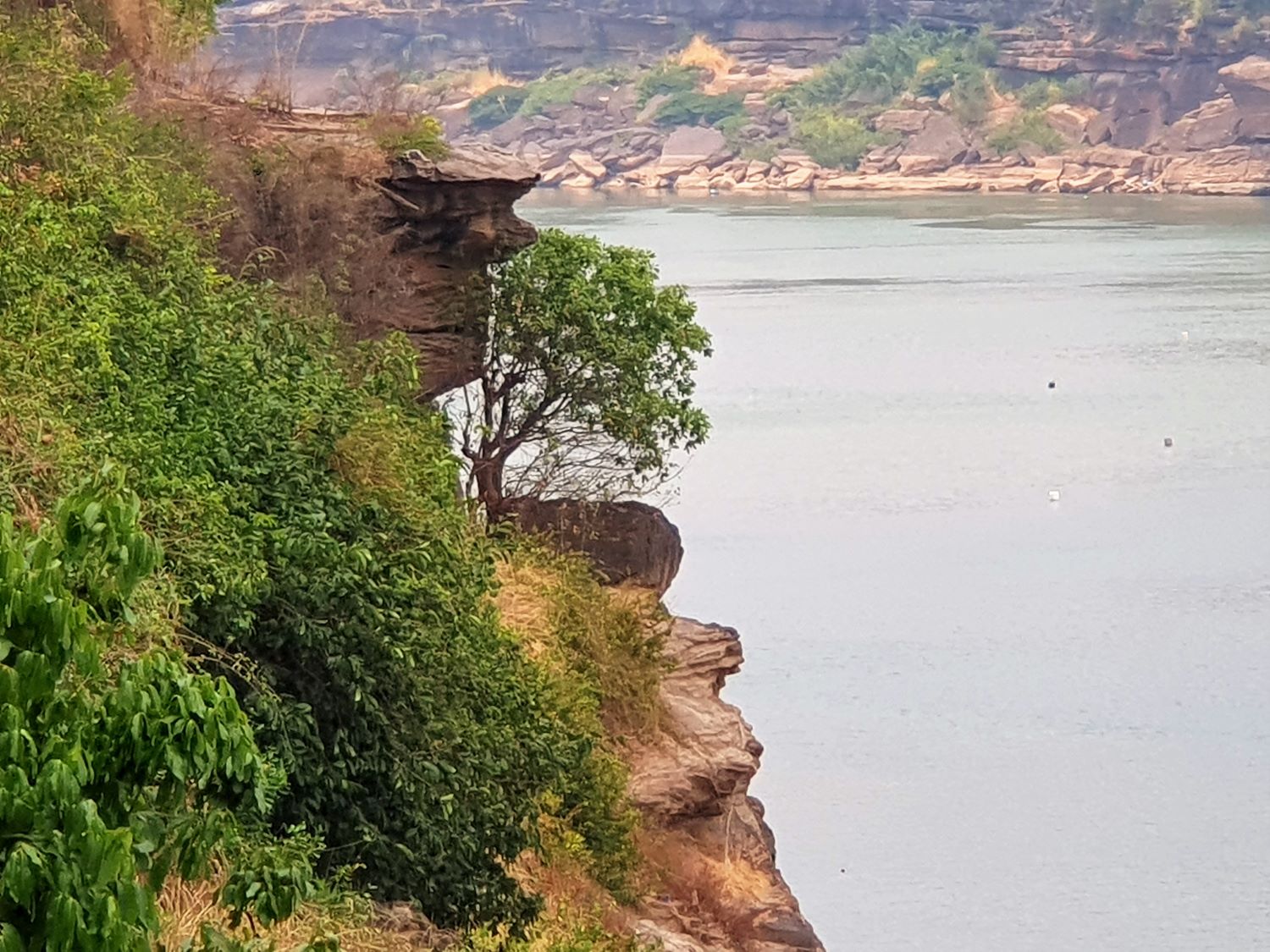
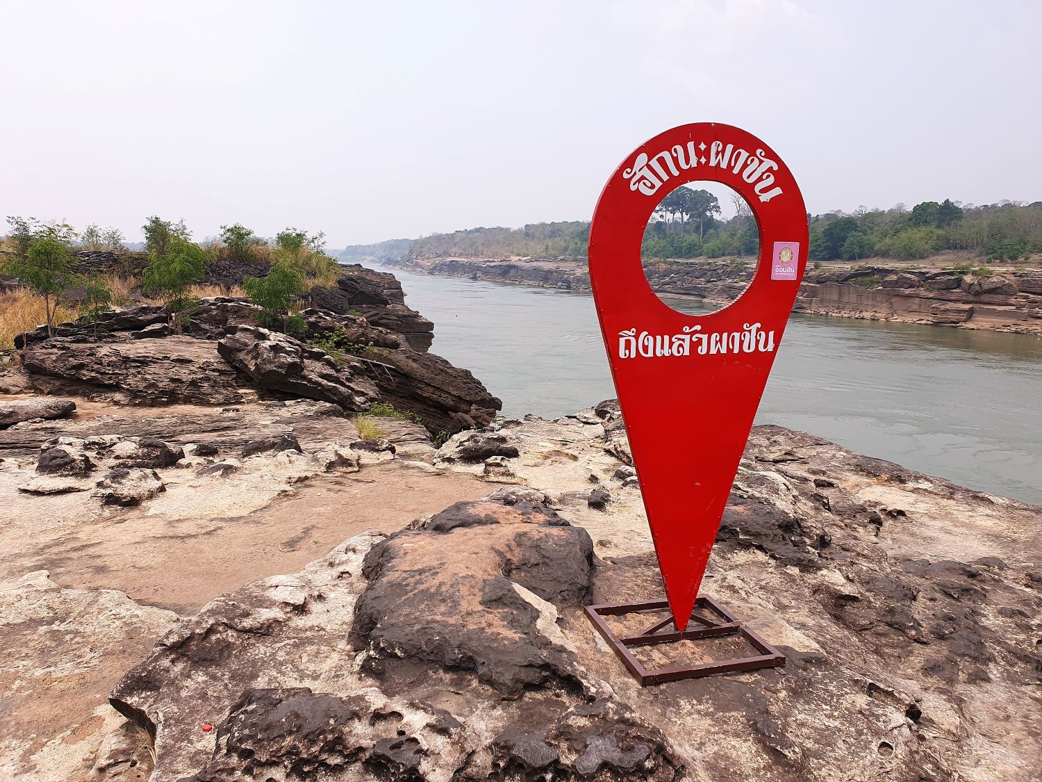
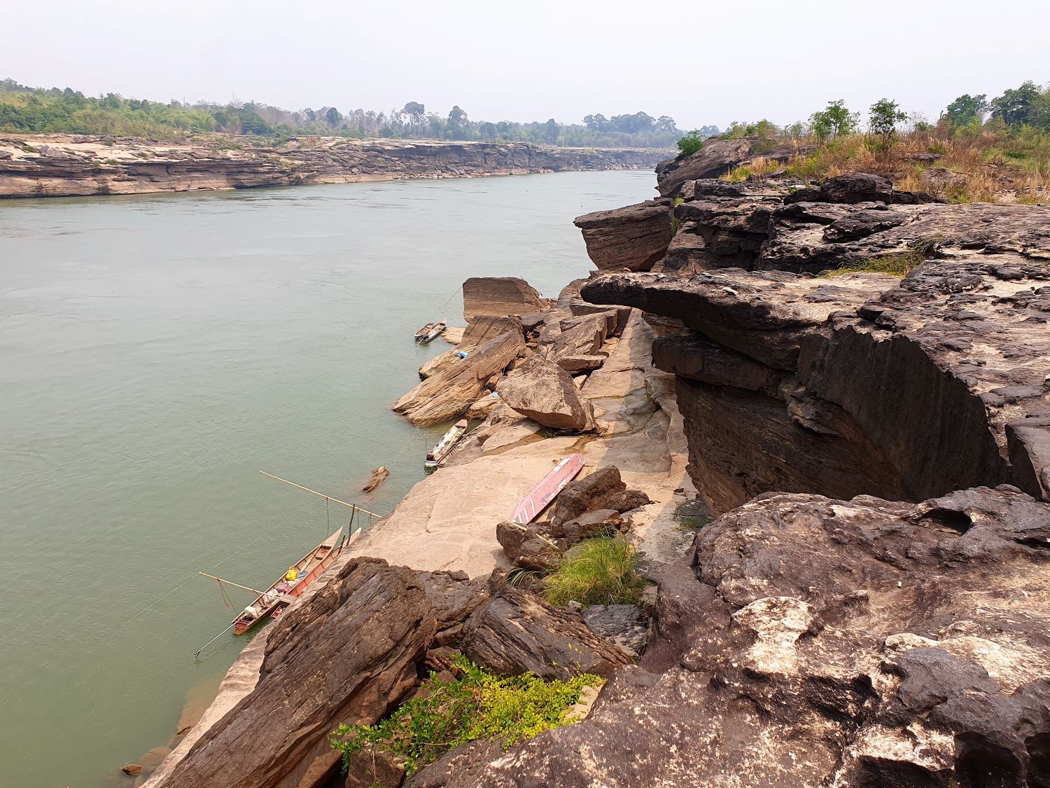
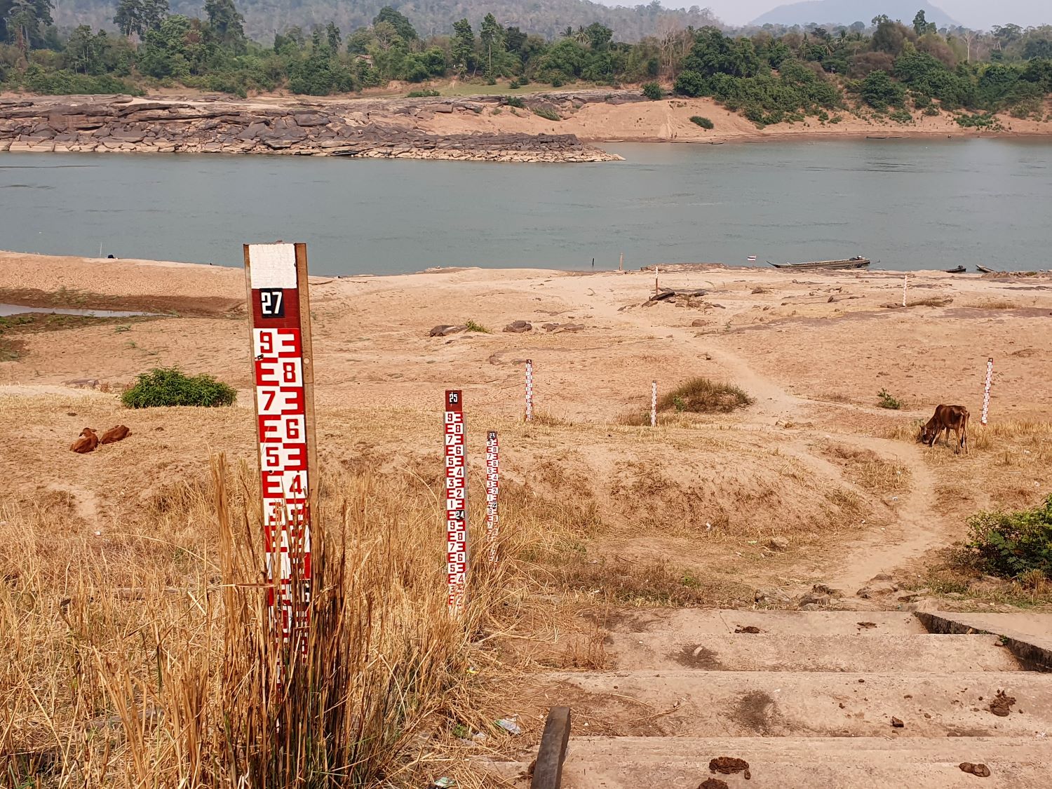
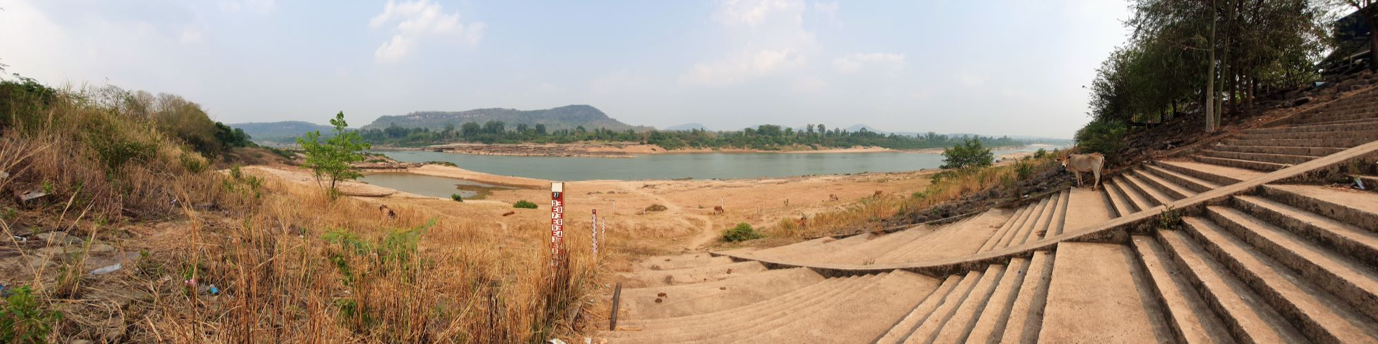
Pha Chan....... As with the Giant Rock Pillar there is no entry fee here in this part of Pha Taem National Park. Pha Chan is a rock ledge viewpoint and at low water, reveals the Mekong water course as straight as any canal. The beauty here is that there are steep cliffs of eroded sandstone on either side cut by the power of water and as symmetrical as if cut by a human hand. Yet even here local fishermen have placed ladders to reach the water far below.
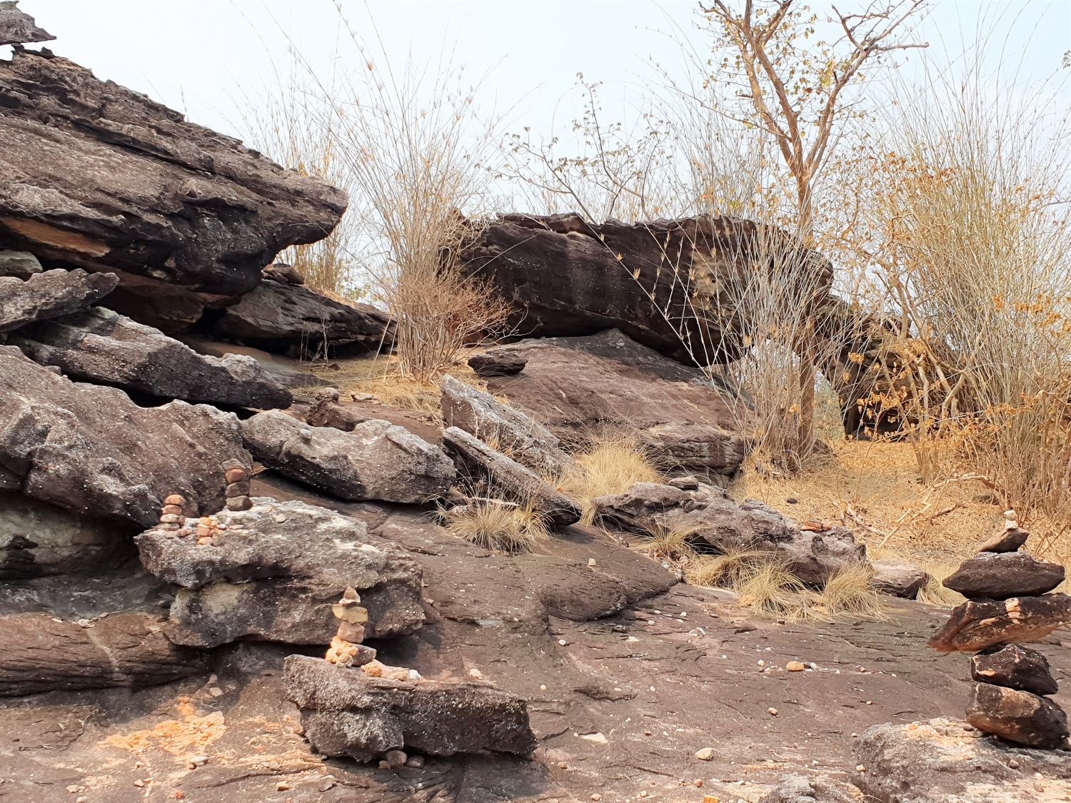
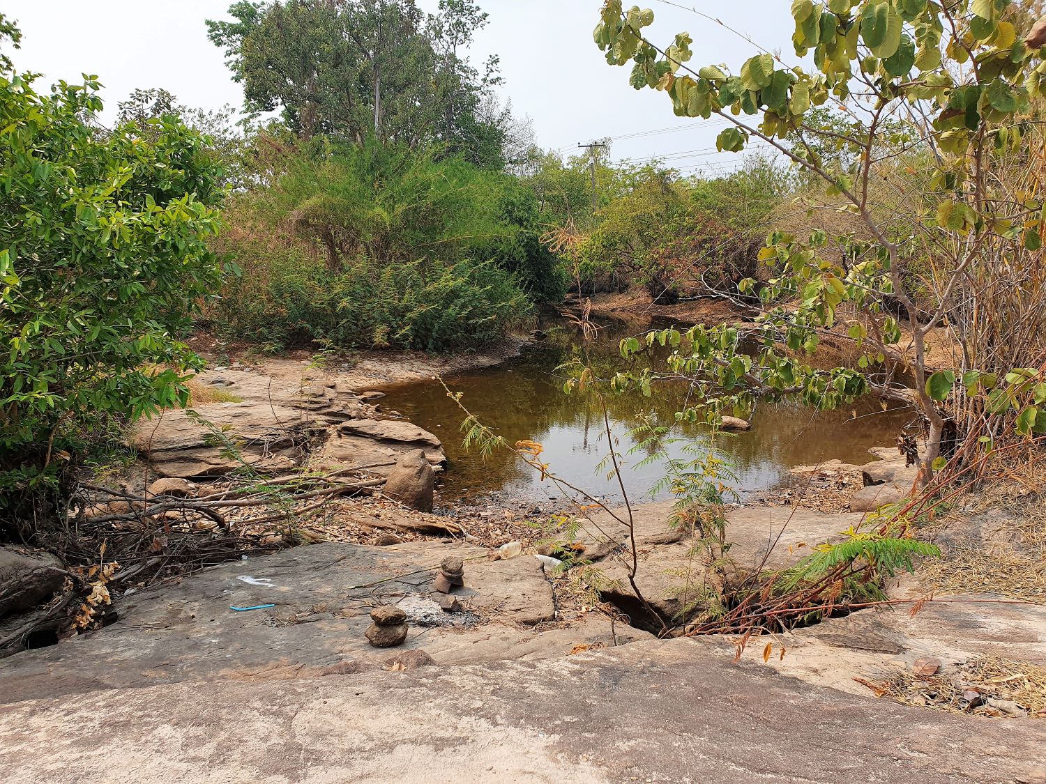
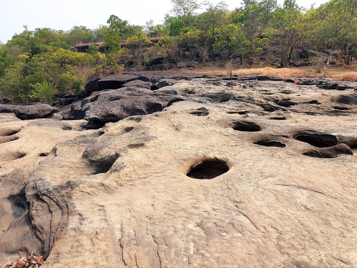
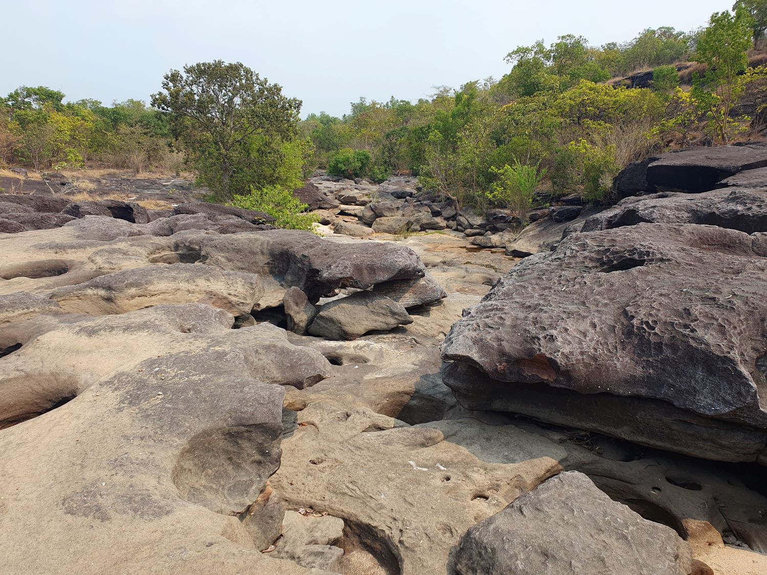
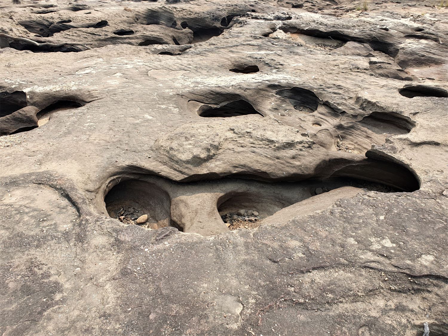
Sam Muan Roo....... Sam Muan Roo is signposted on the road leading to Pha Chan. 'Roo' refers to holes in the rock bed caused by the power of water. I mention this only in passing since the road to reaches it seems too difficult for our vehicle to handle. We need to head back to road 2112 and continue further south reaching Khong Chiam district. Here at Na Pho Klang we head into the mountains once more where there are more attractions.
Pha Chana Dai....... Pha Chana Dai, the main attraction in this part of the park is a cliff with viewpoints offering amazing views across the Mekong River into Laos. There is a question mark over the entrance fee of the park for me and the distance to reach it. However, neither become an issue on this occasion as this part of the park is closed at Dong Na Tham, another rock field. It seems that this time of year in hot dry season there's too great a fire risk. We will try in another direction. Returning back to Na Pho Klang on the 2112 we notice another route into the park, this one giving direct access to the Mekong River.
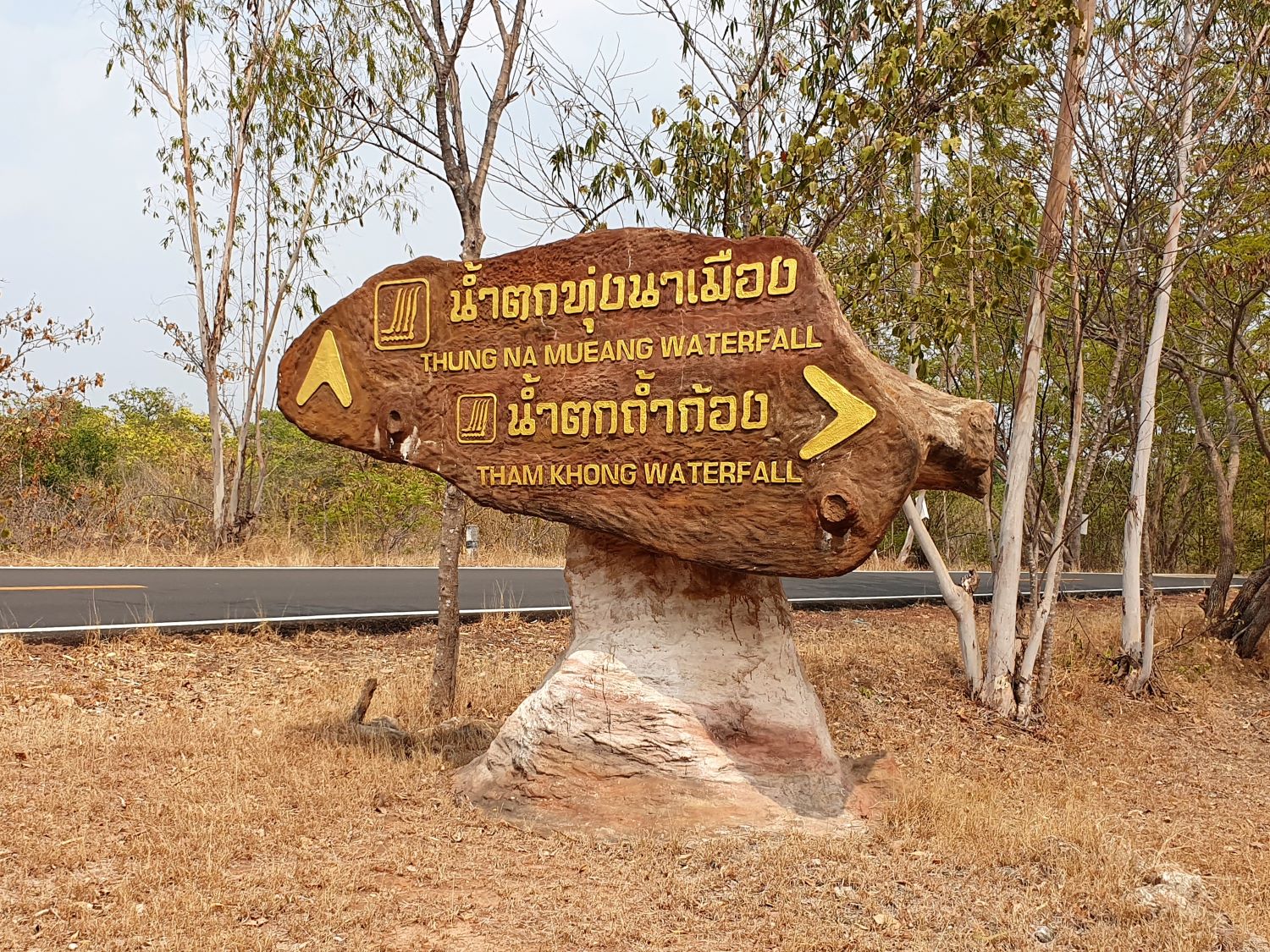
Tham Khong Waterfall....... As I have already noted that while this national park is amazing at any time of year, there are some disadvantages in the dry season. In these conditions soil erosion has created a barren rock landscape. Vegetation hangs on precariously to life without water and there is little soil to retain it. This can only mean one thing for the waterfalls in the park: They are all bone dry. As I have mentioned, there are some amazing cliff viewpoints looking across the Mekong so it's clear that this is where most of the waterfalls are. Tham Khong Waterfall is typical among these. The same applies to the next location.
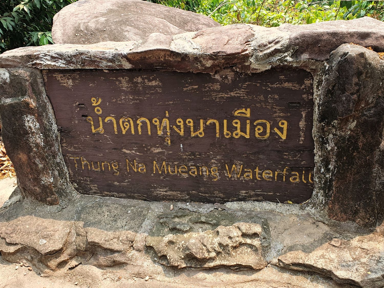
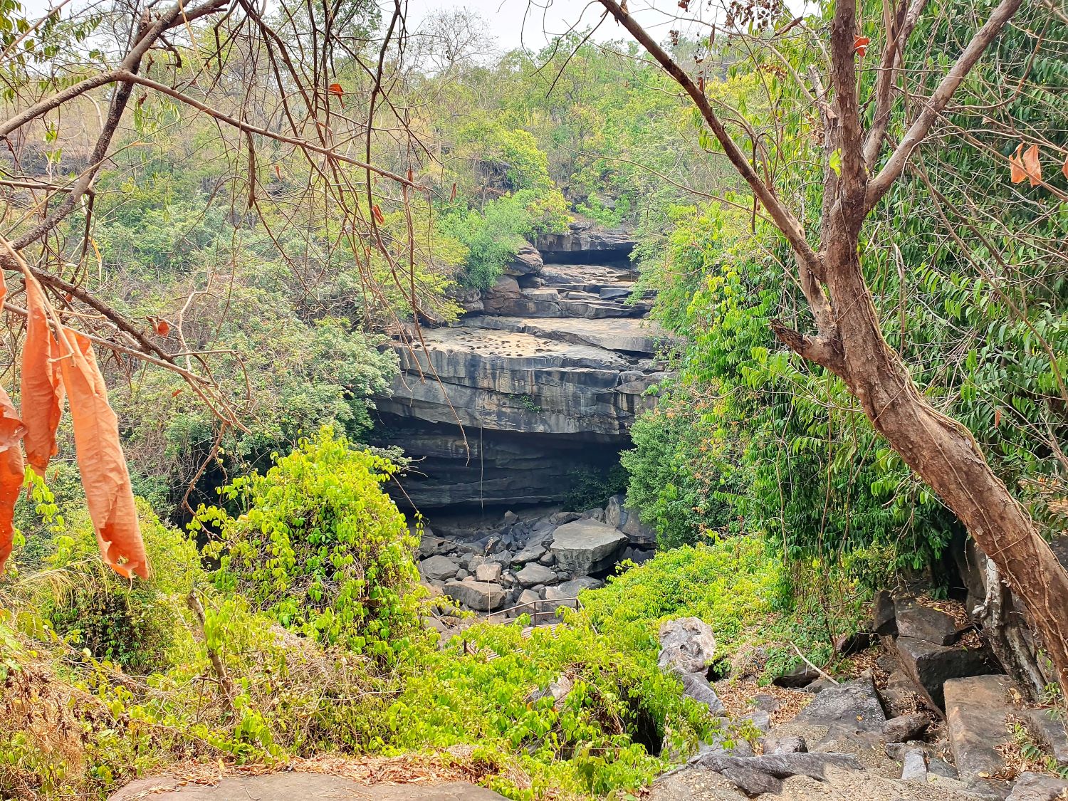
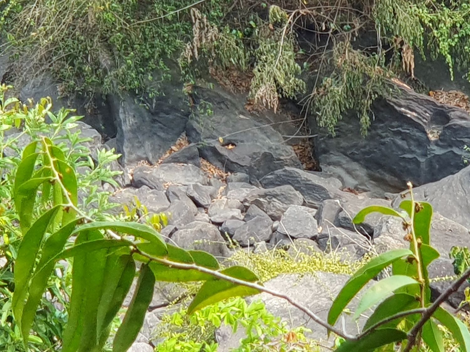
Namtok Thung Na Mueang....... Namtok Thung Na Mueang is a beautiful medium-sized waterfall with the water gushing down the rocks with the highest level elevated about 25 metres, surrounded by many different flower plants especially from October to December. As I see photos of this waterfall on the Tourism Authority of Thailand website with its amazing cascading waterfall and compare it to as it is now, you wouldn't think it was the same location. The one advantage of a visit here this time of year is to view the potholes created during monsoon seasons.
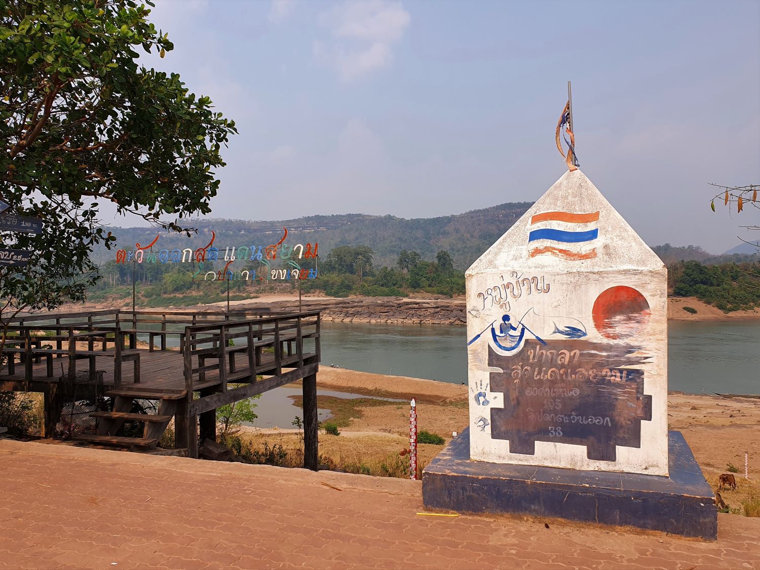
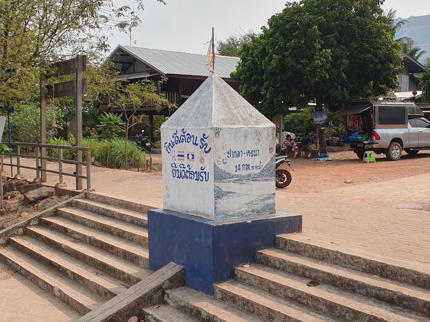
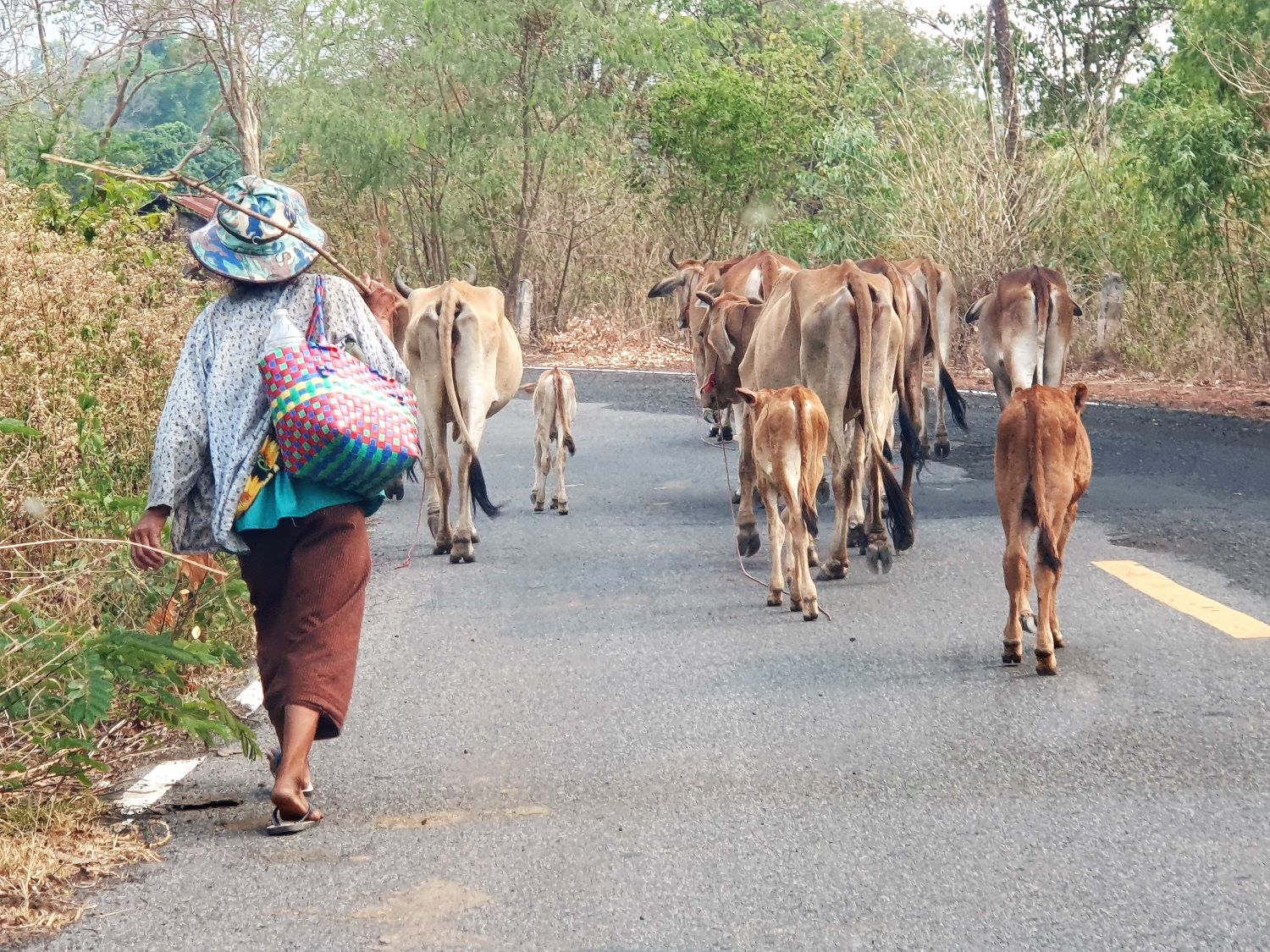
Ban Pak (most easterly point in Thailand)....... From Namtok Thung Na Mueang the road actually continues to the western bank of the Mekong River and turns north. It finally ends after 14 kms at Ban Pak La Border. Although physically this is a crossing point into Laos it is not officially recognised, there being just a simple cabin from which activity can be monitored. The village is small, just 100 people I recon and facilities are limited. For example, it's hard to get an internet signal here. Cumon Elon Musk, get this sorted! However, this village is unique in one particular respect. This is the most easterly piece of land in the whole of Thailand. From here it's quite a distance back to the 2112 where we can continue south.
Khong Chiam....... Finally, we reach Khong Chiam on the Mekong where hopefully we will find more comfortable accommodation than we have for the last two nights. After rejecting a couple of resort style accommodations, we locate Khong Chiam Hotel 2. This offers a great improvement in comfort and functionality for a reasonable price. This includes breakfast however basic I expect it to be. It's also in a good location to access the night market and shops. From here we can easily cover the southern part of the Pha Taem National Park as well as other locations around the Sirindhorn Dam. I should note that this section of the tour is quite light on my budget and for change in the pocket, more than enough food can be found in the market. As I retire after another hot and busy day, I continue to be impressed with everything achieved and tomorrow is expected to be no different.
Next Page.
Not Recommended....... Pool Villa has been a good location to continue our travels and enter one of the most picturesque districts in the province. The bed is really comfortable but oh dear! In other situations, we would have to rejected it. It's certainly the most poorly maintained accommodation so far on this tour. The bathroom, is a complete wreck, and the lack of workspace means our belongings are cluttered all over the floor.
Well, an advantage of persevering is that we can retrace our steps and enter Pha Taem National Park from the north which would really be impractical if we had continued to Khong Chiam.
Pha Taem National Park....... Pha Taem National Park covers an area of 340 square kilometres, where plateaus and hills dominate the parks landscape. There are sheer cliffs, which resulted from earthquakes. Most trees belong to the deciduous dipterocarp forest. Irregular shaped sandstone is found scattered throughout the area. The park covers the districts of Khong Chiam, Sri Mueang Mai, and Pho Sai, all adjacent to Laos PDR with the Mekong River as the border. The Pha Taem National Park Office is located at Ban Nong Phue Noi, Huai Phai sub district, Khong Chiam district. The general geography of the park consists of a plateau and hills. There are also steep cliffs caused by the separation of the Earth’s surface. There are beautiful flowering plants growing on the stony ground after the rains.
The park can be entered from several directions and today we retrace our steps back to Pho Sai district which is the most northerly of the three districts the park occupies.
Giant Rock Pillar....... The Giant Rock Pillar, Sao Chaliang Yai in Thai, is located a few kilometres from rural road 2112 at Samrong. This giant rock pillar is a prime example of many featured in the park. The process that created them is the same. The sandstone rock bed was influenced by external forces or have been caused by the expansion and contraction when the weather was hot during the day and cold at night. Cracks and joints developed in the sandstone bed. The size of these cracks and joints depends on external forces and where they are weak, they are easily eroded. Later, these cracks become wider caused by both vertical and horizontal erosion to the bed rock. Sandstone which is normally strong will be eroded little by little. The eroded parts are then destroyed and washed away while the hard parts remain creating monolithic rock pillars.
We now proceed just a couple of kilometres more and reach the mighty Mekong River.
Pha Chan....... As with the Giant Rock Pillar there is no entry fee here in this part of Pha Taem National Park. Pha Chan is a rock ledge viewpoint and at low water, reveals the Mekong water course as straight as any canal. The beauty here is that there are steep cliffs of eroded sandstone on either side cut by the power of water and as symmetrical as if cut by a human hand. Yet even here local fishermen have placed ladders to reach the water far below.
Sam Muan Roo....... Sam Muan Roo is signposted on the road leading to Pha Chan. 'Roo' refers to holes in the rock bed caused by the power of water. I mention this only in passing since the road to reaches it seems too difficult for our vehicle to handle. We need to head back to road 2112 and continue further south reaching Khong Chiam district. Here at Na Pho Klang we head into the mountains once more where there are more attractions.
Pha Chana Dai....... Pha Chana Dai, the main attraction in this part of the park is a cliff with viewpoints offering amazing views across the Mekong River into Laos. There is a question mark over the entrance fee of the park for me and the distance to reach it. However, neither become an issue on this occasion as this part of the park is closed at Dong Na Tham, another rock field. It seems that this time of year in hot dry season there's too great a fire risk. We will try in another direction. Returning back to Na Pho Klang on the 2112 we notice another route into the park, this one giving direct access to the Mekong River.
Tham Khong Waterfall....... As I have already noted that while this national park is amazing at any time of year, there are some disadvantages in the dry season. In these conditions soil erosion has created a barren rock landscape. Vegetation hangs on precariously to life without water and there is little soil to retain it. This can only mean one thing for the waterfalls in the park: They are all bone dry. As I have mentioned, there are some amazing cliff viewpoints looking across the Mekong so it's clear that this is where most of the waterfalls are. Tham Khong Waterfall is typical among these. The same applies to the next location.
Namtok Thung Na Mueang....... Namtok Thung Na Mueang is a beautiful medium-sized waterfall with the water gushing down the rocks with the highest level elevated about 25 metres, surrounded by many different flower plants especially from October to December. As I see photos of this waterfall on the Tourism Authority of Thailand website with its amazing cascading waterfall and compare it to as it is now, you wouldn't think it was the same location. The one advantage of a visit here this time of year is to view the potholes created during monsoon seasons.
Ban Pak (most easterly point in Thailand)....... From Namtok Thung Na Mueang the road actually continues to the western bank of the Mekong River and turns north. It finally ends after 14 kms at Ban Pak La Border. Although physically this is a crossing point into Laos it is not officially recognised, there being just a simple cabin from which activity can be monitored. The village is small, just 100 people I recon and facilities are limited. For example, it's hard to get an internet signal here. Cumon Elon Musk, get this sorted! However, this village is unique in one particular respect. This is the most easterly piece of land in the whole of Thailand. From here it's quite a distance back to the 2112 where we can continue south.
Khong Chiam....... Finally, we reach Khong Chiam on the Mekong where hopefully we will find more comfortable accommodation than we have for the last two nights. After rejecting a couple of resort style accommodations, we locate Khong Chiam Hotel 2. This offers a great improvement in comfort and functionality for a reasonable price. This includes breakfast however basic I expect it to be. It's also in a good location to access the night market and shops. From here we can easily cover the southern part of the Pha Taem National Park as well as other locations around the Sirindhorn Dam. I should note that this section of the tour is quite light on my budget and for change in the pocket, more than enough food can be found in the market. As I retire after another hot and busy day, I continue to be impressed with everything achieved and tomorrow is expected to be no different.
Next Page.
Ubon Ratchathani
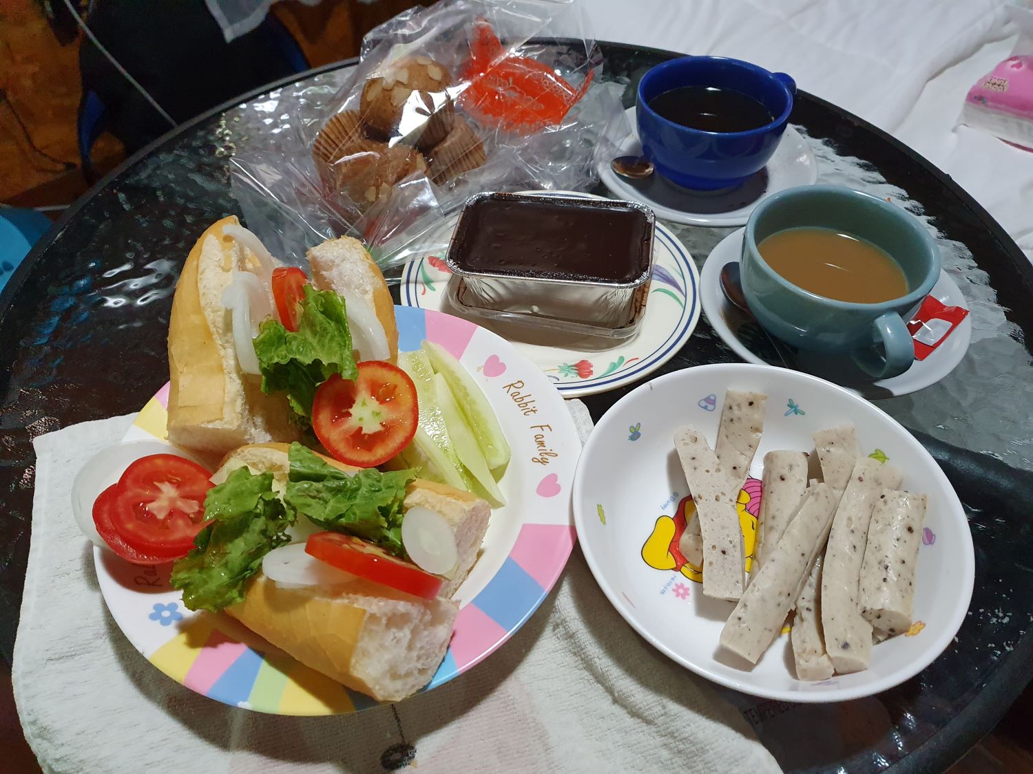
Typical Self Catering Breakfast at Chanadai Resort Hotel, Na Pho Klang,
Khong Chiam District
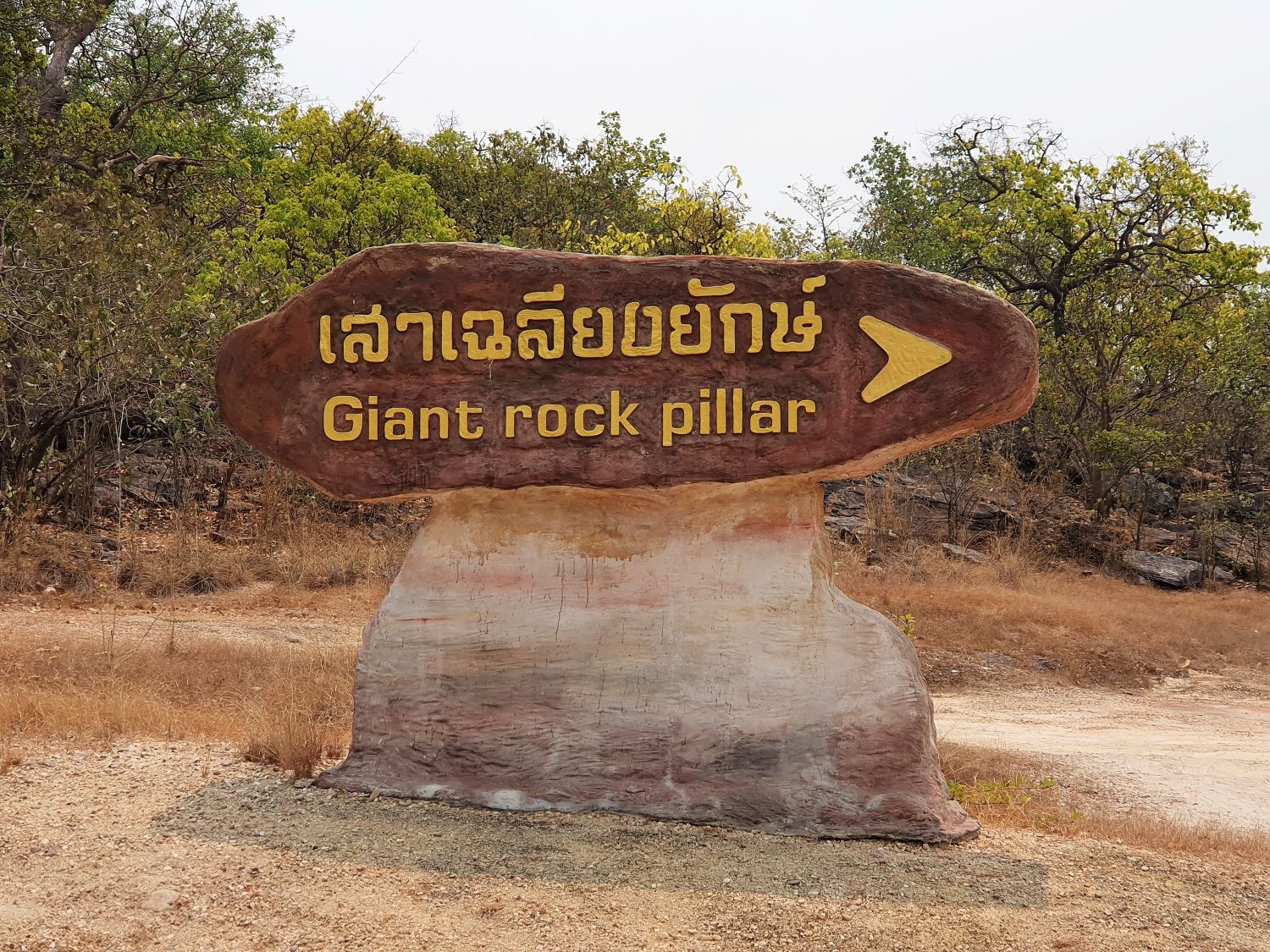
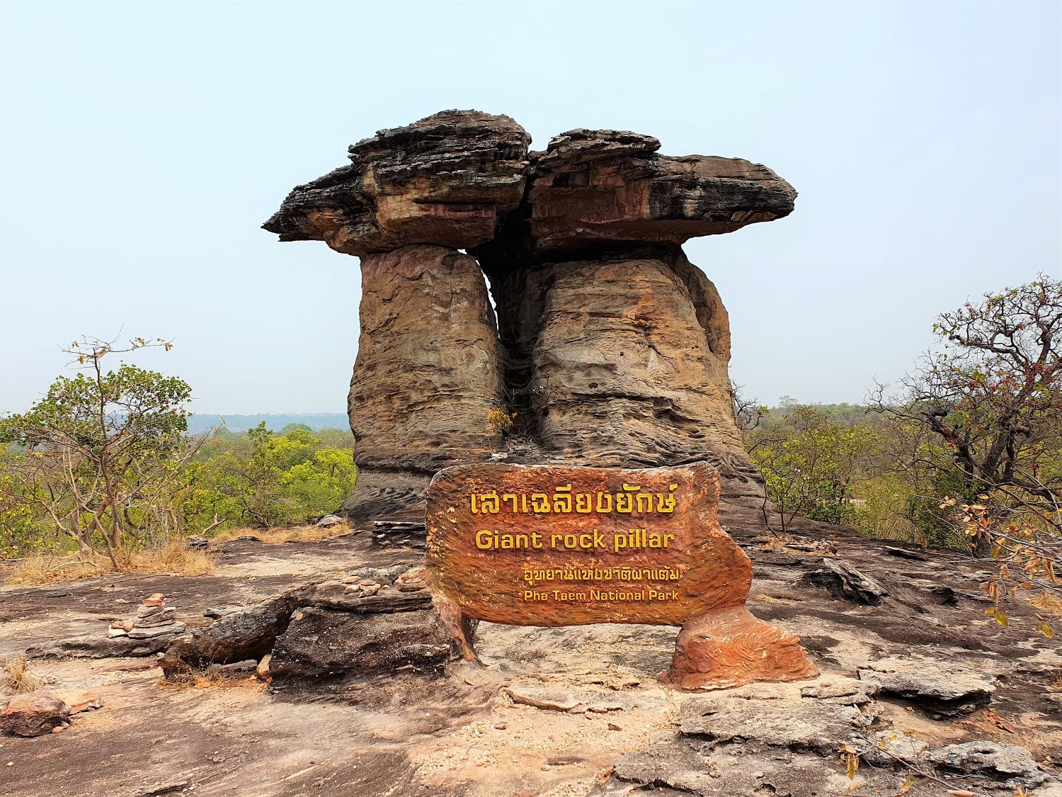
Sao Chaliang Yai (Prehistoric giant rock), Samrong, Pho Sai District
Sam Muen Roo, Samrong, Pho Sai District
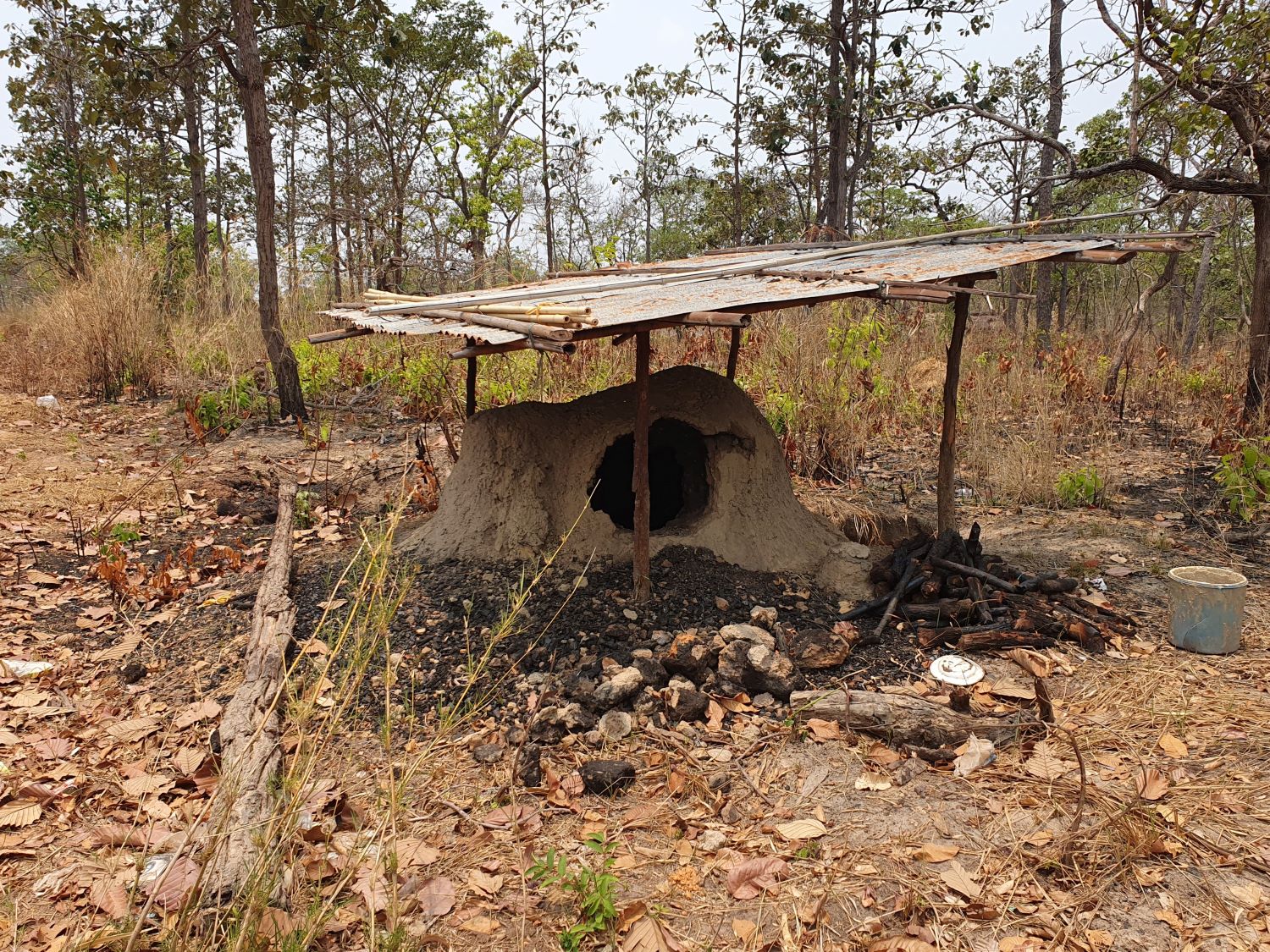
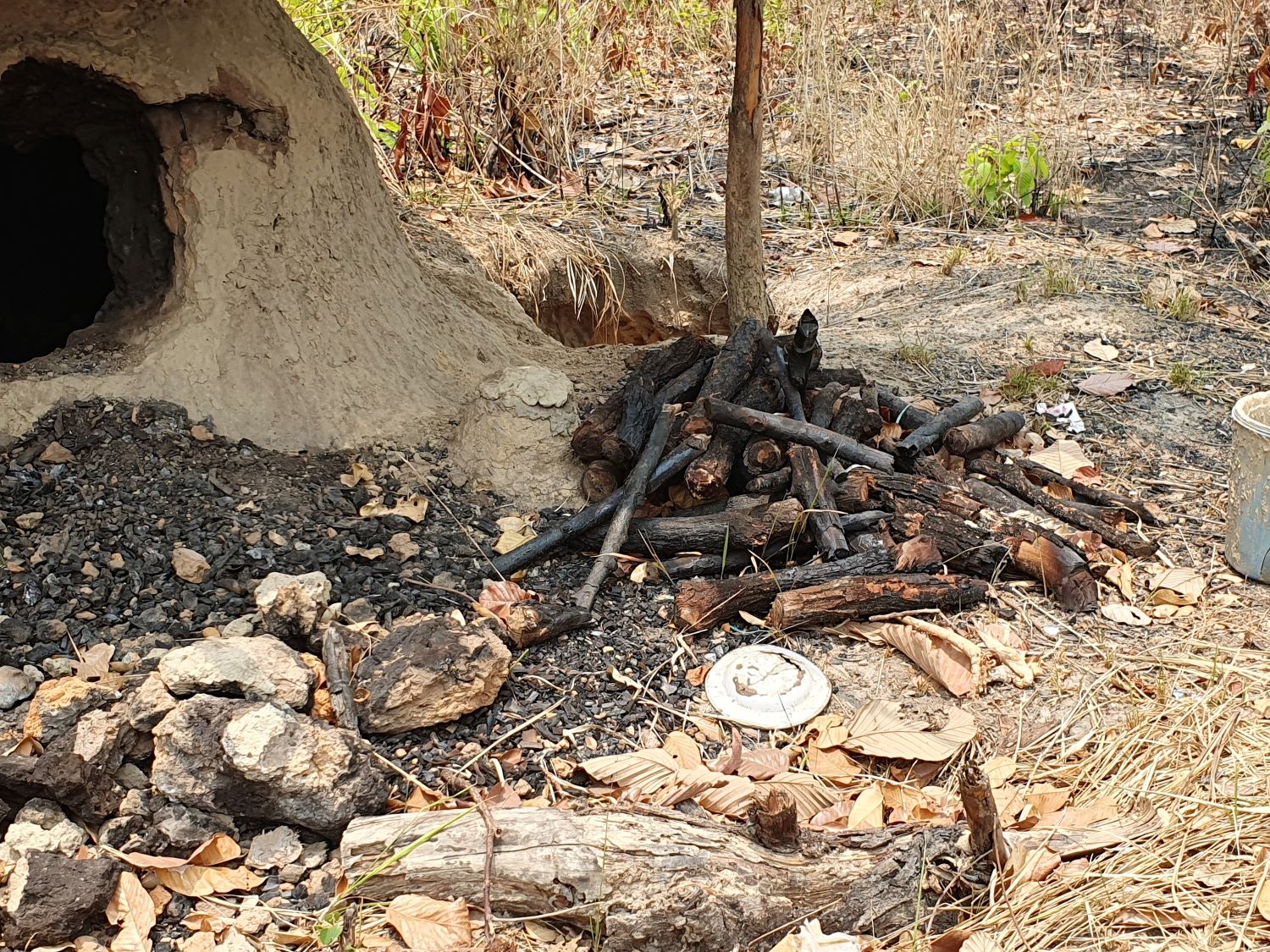
Traditional Carcoal Method near Sam Muen Roo, Samrong, Pho Sai District
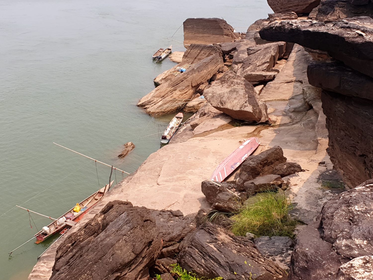
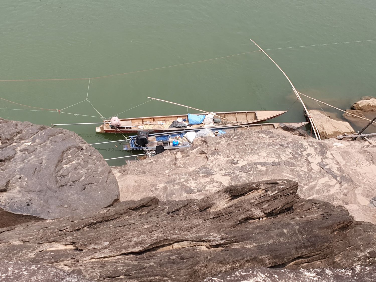

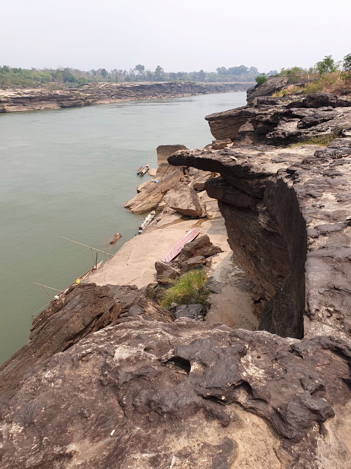
Pha Chan, Na Pho Klang,
Khong Chiam District
Tham Khong Waterfall, Na Pho Klang,
Khong Chiam District
Thung Na Mueang Waterfall, Na Pho Klang, Khong Chiam District
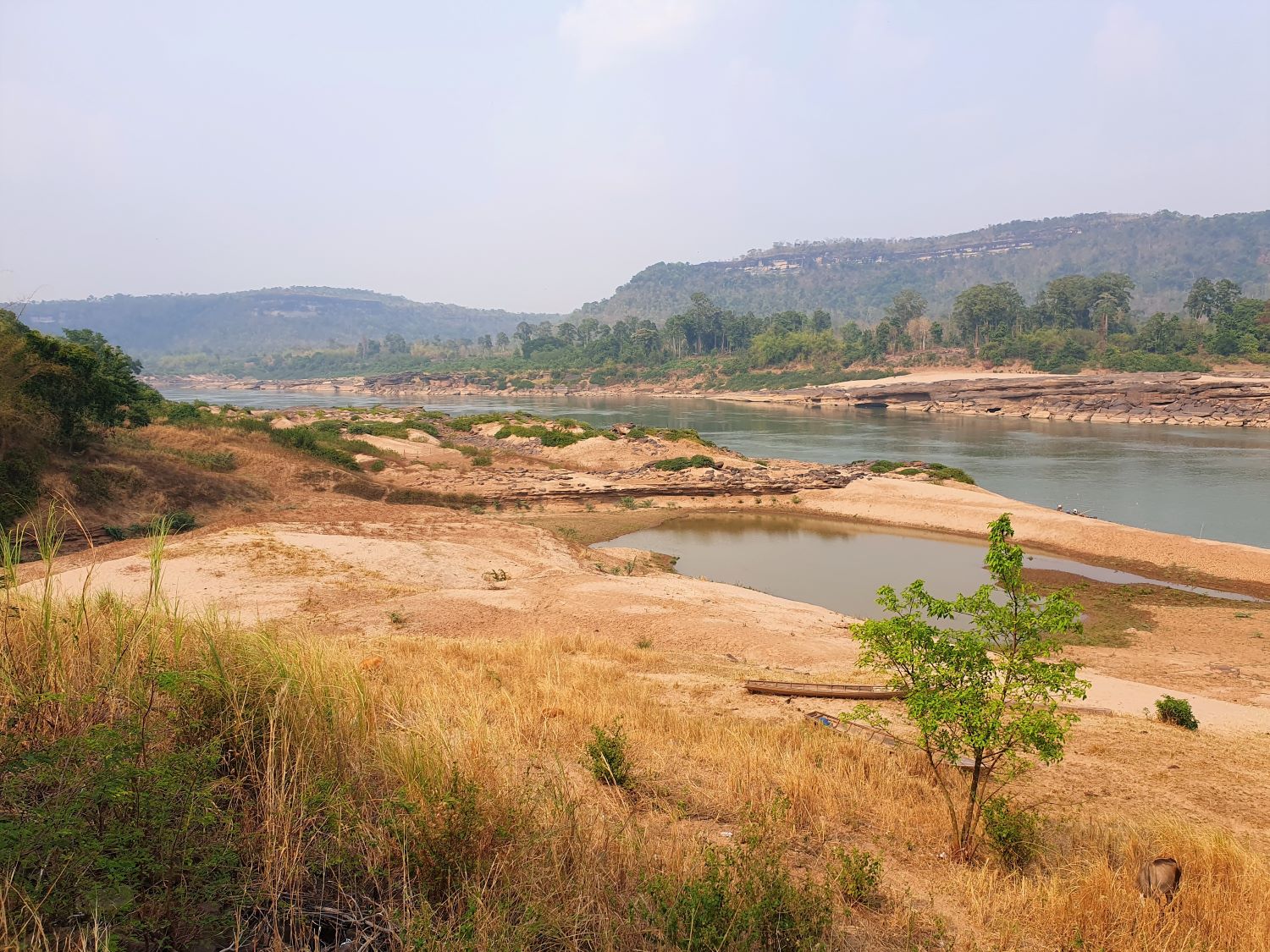
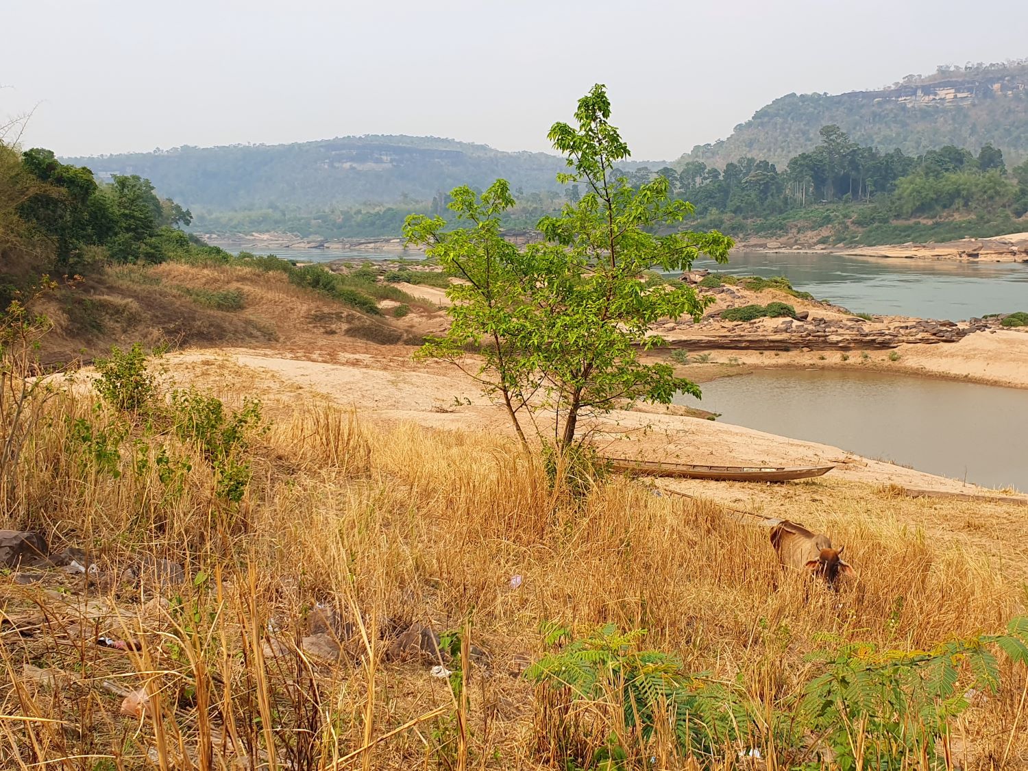
Ban Pak, Na Pho Klang, Khong Chiam District
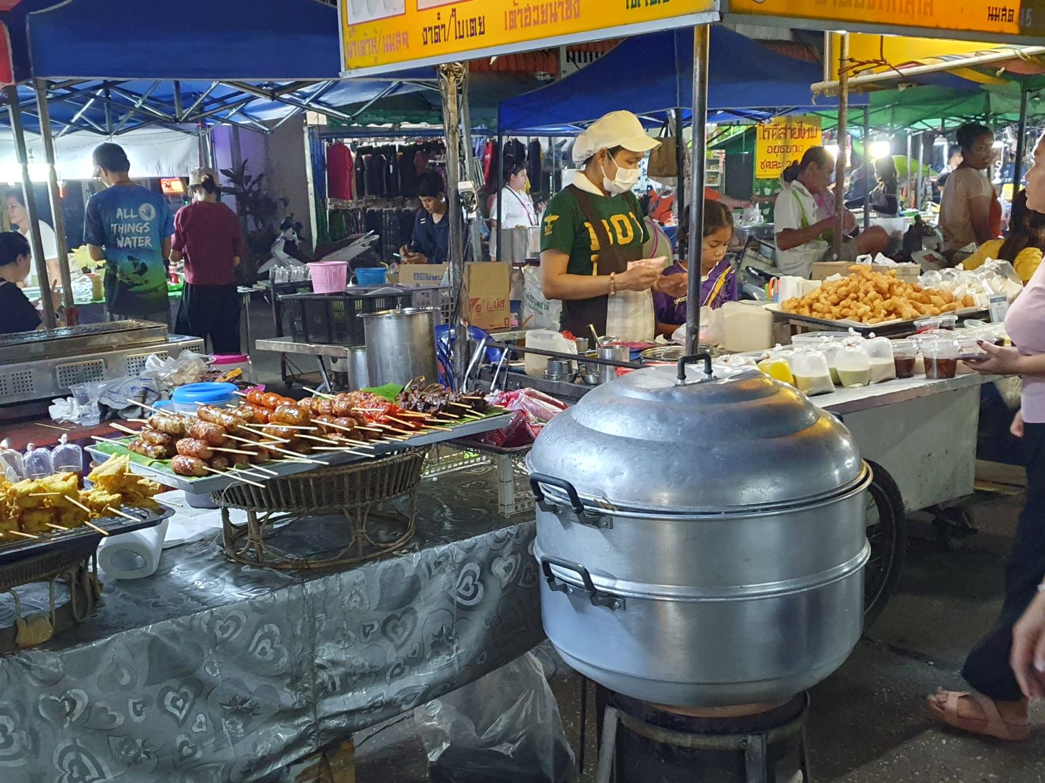
Khong Chiam Night Market, Khong Chiam