|
|
 |
|
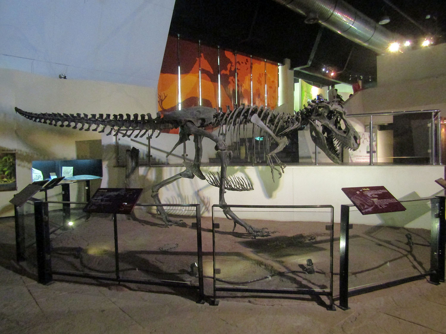
Kalasin Kalasin is one of the northeast (Isan) provinces (changwat) of Thailand. The province was established by the Act Establishing Changwat Kalasin, BE 2490 (1947), and it came into existence on 1 October 1947. Neighboring provinces are (from north clockwise) Sakon Nakhon, Mukdahan, Roi Et, Maha Sarakham, Khon Kaen, and Udon Thani. The seal of the province shows a pond in front of the Phu Phan Mountains which form the boundary of the province. The water in the pond is black, as the name Kalasin means "black water". The big clouds as well as the water symbolize the fertility of the province. Economy: Kalasin is an agricultural province producing sticky rice and other cash crops such as manioc (cassava) and sugar cane. Families are generally poor in this essentially rural area and make ends meet by producing baskets and the silk for which the region is renowned. Geography: Most of the province is covered by a hilly landscape. The town of Kalasin is at an elevation of 152 m. In the north is the Lam Pao Dam built from 1963-1968. It stores 1,430 million m³ of water for flood prevention and agriculture. The Lam Pao reservoir effectively cuts the northern part of the province in half, but there are car ferries connecting the district of Sahatsakhan in the east with the district Nong Kung Si in the west, saving up to one hour off the journey by road. On the northwestern creek of the reservoir a road bridge connects the village of Ban Dong Bang in the west with the district town of Wang Sam Mo in the east. Although the bridge was constructed several years ago (pre-2000) it is not featured (2006) on any commercially available road maps. The Phu Phan mountain range marks the border with Sakhon Nakhon Province, part of which is preserved as a national park. Kalasin is famous for the dinosaur fossils found at Phu Kum Khao (Sahatsakhan District), the largest dinosaur site in Thailand. Most of the fossils are sauropods from 120 million years ago. History: Archaeological excavations show that the Lawa tribe lived in the area some 1,600 years ago. The first official town was founded in 1793. During the Thesaphiban reforms in the reign of King Rama V at the beginning of the 20th century, the town (mueang) was upgraded to a province. In 1932, when the country experienced the great economic depression, the province was demoted and absorbed as a district by Maha Sarakham Province to reduce the financial burden on the country, Kalasin was dependent on Maha Sarakham for 16 years. After the great recession and World War II, it once again became a province in 1947. Tourism: Kalasin is one of the least visited provinces in Thailand, perhaps due to the lack of rail and air links. Most visitors head for the Sirindhorn Museum and the Lam Pao Dam area. Historic sites are generally absent but the province can boast of the most significant dinosaur fossil site in Thailand. Source: Wikipedia |
Kalasin Province |
Historic Sites: Sirindhorn Museum, Prathat Yaku at Muang Fa Daet Song Yang
Religious Sites: Wat Phuttanimit Phra Saiyat
Natural Sites: Phu Kum Khao Excavation Site, Lam Pao Reservoir and Dam, Lampao Wildlife and Nature Education Centre, Phu Faek Forest Park
Religious Sites: Wat Phuttanimit Phra Saiyat
Natural Sites: Phu Kum Khao Excavation Site, Lam Pao Reservoir and Dam, Lampao Wildlife and Nature Education Centre, Phu Faek Forest Park